Agoracom Blog Home

Posts Tagged ‘gold’

FEATURE: American Creek $AMK.ca encounters high grade #Gold / #Silver at Treaty Creek north of, and in the same system as #Seabridge $AMK.ca $SA $SEA.ca

Posted by AGORACOM-JC at 10:54 AM on Tuesday, April 10th, 2018

AMK: TSX-V, OTCBB: ACKRF

  • Intersected various mineralized zones
  • Most significant was 337.5m of continuous mineralization grading 0.76 g/t gold from 2 to 339.5m depth,
  • Including a higher grade intercept of 124.5m grading 0.98 g/t gold from 53.0 to 177.5m


Monarques Gold $MQR.ca investigating potential game-changer for its wholly-owned Wasamac Gold project $MUX.ca $SII.ca

Posted by AGORACOM-JC at 8:48 AM on Thursday, April 5th, 2018

Monarquesgold hub large

  • Retained BBA to conduct a conceptual study for the transportation of gold-bearing material from the Wasamac deposit to an existing processing plant with an authorized tailings management facility in the region for custom milling

BBA retained to confirm Management’s strategy and to assess various options

MONTREAL, April 5, 2018 – MONARQUES GOLD CORPORATION (“Monarques” or the “Corporation”) (TSX-V: MQR) (OTCMKTS: MRQRF) (FRANKFURT: MR7) is pleased to announce that it has retained BBA to conduct a conceptual study for the transportation of gold-bearing material from the Wasamac deposit to an existing processing plant with an authorized tailings management facility in the region for custom milling. Since acquiring the Wasamac Gold project from Richmont Mines, Monarques’ management has been working towards unlocking the tremendous potential value of the project.

Monarques’ management has made it a priority to investigate any and all avenues to make Wasamac economical and profitable at a significantly lower gold price than the scenario that the previous owner was working with. A major breakthrough that Monarques has achieved is the realization that the Wasamac Gold project can be serviced by bulk, railcar transport. As such, Monarques could eliminate the extremely large capital outlay required to build a mill as it could potentially ship the Wasamac ore to any of a number of possible custom milling opportunities in the vicinity of Wasamac (see map of potential sites).

“We look forward to working with BBA to confirm our belief that the Wasamac Gold project could be profitable at a significantly lower gold price than what was envisioned under the previous owner. This is a potential game-changer for Monarques and its shareholders,” said Jean-Marc Lacoste, President and Chief Executive Officer of Monarques. “Following the update of the Wasamac resource estimate last October, which established a measured and indicated resource of 2,587,900 ounces of gold (see press release), we decided to look into the various possible operating scenarios, including custom milling. This study will allow us to collect data and information for the option of mining the Wasamac deposit using custom milling at one of the processing plants in Quebec and Ontario. This option has the advantage of significantly reducing the initial cost of the project as we would not have to build a mill or a tailings facility.”

The first phase of the study will establish an inventory of the main mining and processing sites in operation and accessible by road and/or rail in the Abitibi region, in both Ontario and Quebec, with their locations and qualifications. The second phase will develop a concept for the transportation of mineralization and/or treatment sludge for the three best options selected from the sites identified in the previous phase. The main goal of this phase is to design a concept for transporting the mineralization from the Wasamac deposit to a regional processing plant and tailings facility for custom milling. The Corporation expects to receive the results of this study in May 2018.

The technical and scientific content of this press release has been reviewed and approved by Marc-André Lavergne, P.Eng., the Corporation’s qualified person under National Instrument 43‑101.

ABOUT MONARQUES GOLD CORPORATION

Monarques Gold Corporation (TSX.V:MQR) is an emerging gold producer focused on pursuing growth through its large portfolio of high-quality projects in the Abitibi mining camp in Quebec, Canada. The Corporation currently owns close to 300 km² of gold properties (see map), including the Beaufor Mine, the Croinor Gold (see video), Wasamac, McKenzie Break and Swanson advanced projects, and the Camflo and Beacon mills, as well as six promising exploration projects. It also offers custom milling services out of its 1,600 tonne-per-day Camflo mill. Monarques enjoys a strong financial position and has more than 150 skilled employees who oversee its operating, development and exploration activities.

ABOUT BBA

BBA is a Canada-wide consulting engineering firm that offers multidisciplinary consulting services in engineering, project management and environment. Thanks to its cutting-edge expertise in the energy, mining and metals, biofuels, and oil and gas sectors, BBA is now recognized for the excellence of its services, from pre-study to onsite commissioning support and detailed engineering.

The firm relies on a team of over 750 professionals from its 11 offices across Canada to carry out local, national and international mandates, thereby helping its industrial clients implement the most reliable, profitable and eco-friendly solutions.

Forward-Looking Statements

The forward-looking statements in this press release involve known and unknown risks, uncertainties and other factors that may cause Monarques’ actual results, performance and achievements to be materially different from the results, performance or achievements expressed or implied therein. Neither TSX Venture Exchange nor its Regulation Services Provider (as that term is defined in the policies of the TSX Venture Exchange) accepts responsibility for the adequacy or accuracy of this press release.

#Gold Climbs After #China Imposes Tariffs $AMK.ca $EXS.ca $GGX.ca $GR.ca $GZD.a $MQR.ca

Posted by AGORACOM-JC at 11:41 AM on Monday, April 2nd, 2018
  • Gold prices rose Monday after China imposed tariffs on a range of U.S. goods, following through on a promise to retaliate against the Trump administration’s penalties on imports of Chinese steel and aluminum
  • Gold for June delivery added 0.8% to $1,337.40 a troy ounce on the Comex division of the New York Mercantile Exchange
By Amrith Ramkumar

April 2, 2018 10:19 a.m. ET

Gold prices rose Monday after China imposed tariffs on a range of U.S. goods, following through on a promise to retaliate against the Trump administration’s penalties on imports of Chinese steel and aluminum.

Gold for June delivery added 0.8% to $1,337.40 a troy ounce on the Comex division of the New York Mercantile Exchange. Prices have stayed between about $1,305 and $1,360 this year, moving within that range based on safe-haven demand from investors, swings in the dollar and worries about higher interest rates.

Some money managers favor gold when they think markets might turn rocky. Protectionist trade policies from the U.S. and China have stoked fears of a global trade war that leads to higher manufacturing costs and eventually slower economic growth, pushing some traders to scoop up gold.

The Chinese penalties range from 25% on American pork and eight other kinds of goods to 15% on fruit and 120 types of commodities, according to the Chinese Finance Ministry.

“Last night’s tariff news from China spooked the market, took the dollar lower and gave us a lot of safe-haven buying in gold,” said Bob Haberkorn, senior market strategist at RJO Futures.

A weaker dollar boosts gold by making it and other dollar-denominated commodities cheaper for overseas buyers. The WSJ Dollar Index, which tracks the U.S. currency against a basket of 16 others, pared early losses and was recently up less than 0.1%.

Investors will be monitoring speeches from Federal Reserve officials and economic data this week for the latest clues about the path for higher interest rates. Gold struggles to compete with yield-bearing assets as borrowing costs rise, and the prospect of two or three more increases following March’s rate increase has limited price gains, according to analysts.

“Rates are going to hang over any gold rally we have for the remainder of the year,” Mr. Haberkorn said.

Among base metals, copper for May delivery added 0.7% to $3.0480 a pound. Prices fell 7.9% in the first quarter to end an eight-quarter winning streak, hurt by trade tensions and lukewarm Chinese economic data. However, data released over the weekend showed an official gauge of China’s factory activity rose to a three-month high in March, as factories ramped up production following the Lunar New Year holiday.

Some investors expect data to pick up as the year goes on and supply disruptions from mining labor contracts up for renegotiations to buoy prices.

Write to Amrith Ramkumar at [email protected]

Source: https://www.wsj.com/articles/gold-climbs-after-china-imposes-tariffs-1522678783

Monarques Gold $MQR.ca reports new high-grade #gold results from its 2017 drilling program at the Beaufor Mine $MUX.ca $SII.ca

Posted by AGORACOM-JC at 9:28 AM on Tuesday, March 27th, 2018

MONTREAL, March 27, 2018

  • Exploration drilling intersected new veins subparallel to Zone Q, including:
    • 32.28 g/t Au over 2.10 metres, including 62.40 g/t Au over 1.10 metres
    • 7.55 g/t Au over 4.00 metres, including 20.80 g/t Au over 1.00 metre
  • Definition drilling continued to intersect high-grade gold zones, including:
    • 13.41 g/t Au over 4.75 metres, including 89.85 g/t Au over 0.50 metres
    • 17.34 g/t Au over 3.30 metres, including 59.00 g/t Au over 0.80 metres
    • 10.11 g/t Au over 2.50 metres, including 27.40 g/t Au over 0.55 metres
    • 8.82 g/t Au over 2.50 metres, including 25.95 g/t Au over 0.60 metres
  • A 30,000-metre drilling program has been under way at the Beaufor Mine since the beginning of 2018 to increase the resources and extend the mine life. 

MONTREAL, March 27, 2018  – MONARQUES GOLD CORPORATION (“Monarques” or the “Corporation”) (TSX.V:MQR) (OTCMKTS:MRQRF) (FRANKFURT:MR7) is pleased to report new results that mark the end of its 2017 drilling program at the Beaufor Mine. The results are from a total of 7,157 metres of drilling in 52 holes, including 5 exploration holes (2,651 metres) and 47 definition drill holes (4,506 metres). The holes were drilled in multiple areas of the mine, including zone Q, QH2 and 32 and the 350H, 1700 and Granodiorite East projects (see composite schematic section).

Results of exploration drilling:

Zone Q
Zone Q is the main zone currently in production at the Beaufor Mine. Two holes were drilled in the eastern part of the zone, outside the known reserve and resource envelope, to test for structural continuity and the presence of mineralized veins in the hangingwall and footwall. Holes 142-89 and 142-95 (see section 1690E) were drilled to a final depth of 654 and 460 metres, respectively. Both holes intersected Zone Q, as well as mineralized veins in the footwall of the zone (QF veins).

The QF veins returned the following significant results:

  • Hole 142-89 intersected 7.55 g/t Au over 4.00 metres, including 20.80 g/t Au over 1.00 metre, as well as 11.75 g/t Au over 2.00 metres and 24.25 g/t Au over 1.00 metre.
  • Hole 142-95 intersected 32.28 g/t Au over 2.10 metres, including 62.40 g/t Au over 1.10 metres, and 13.74 g/t Au over 2.70 metres, including 36.55 g/t Au over 0.90 metres.

The characteristics of the QF veins are similar to those of the typical known veins at the Beaufor Mine, which are quartz-tourmaline veins with disseminated pyrite associated with diorite dykes.

“The strategy of testing the east and depth extensions of Zone Q with exploration holes has paid off, as we were able to identify a good gold potential in the Zone Q footwall,” said Jean-Marc Lacoste, President and Chief Executive Officer of Monarques. “Based on the results obtained to date, we think that we’ll be able to increase the mineral resource in this area.  We will do more in-depth follow-up on the QF veins as part of the 2018 drilling program already under way.”

1700 and Granodiorite East projects
Three other exploration holes (142-74, 150-63b and 156-13) were drilled in the 1700 and Granodiorite East project areas, for a total of 1,537 metres. The 1700 project returned the best result, with 26.70 g/t Au over 0.50 metres in Hole 156-13 associated with a quartz vein containing 30% pyrite. Additional drilling is needed for a better understanding of the geometry of the veins in this area, as little is currently known about their extensions.

Results of definition drilling:

Zone Q
Six holes were drilled for a total of 1,504 metres. Hole 150-64 tested the eastern part of Zone Q and the remaining five holes were drilled in the western part of the zone. All the holes intersected Zone Q, and some also intersected QH veins less than 100 metres into the Zone Q hangingwall.

The best intersections for Zone Q were:

  • Hole 101-100 intersected 13.41 g/t Au over 4.75 metres, including 89.85 g/t Au over 0.50 metres.
  • Hole 101-183 intersected 18.75 g/t Au over 0.50 metres.

The best results for the QH veins, intersected in the Zone Q hangingwall, were:

  • Hole 150-64 intersected 22.40 g/t Au over 0.70 metres and 58.90 g/t Au over 0.60 metres.
  • Hole 101-100 intersected 46.95 g/t Au over 0.65 metres.
  • Hole 101-104 intersected 16.63 g/t Au over 0.70 metres.

The correlation between the QH and QF veins, located at various distances apart in the Zone Q hangingwall and footwall, is not yet well understood or defined, and additional drilling is needed to better understand their geometry.

Zone QH2

Twenty-two infill holes were drilled on a 12.5 m by 12.5 m spacing from the 193 sublevel in Zone Q, for a total of 1,286 metres of drilling. The holes confirmed the continuity of the zone over a distance of approximately 120 metres along strike and approximately 50 metres vertically.

The best results for Zone QH2 were:

  • Hole 146-37 intersected 17.34 g/t Au over 3.30 metres, including 59.00 g/t Au over 0.80 metres.
  • Hole 142-90 intersected 10.11 g/t Au over 2.50 metres, including 27.40 g/t Au over 0.55 metres.
  • Hole 142-80 intersected 11.25 g/t Au over 0.75 metres.

Zone QH2 is a QH-type vein located in the eastern part of Zone Q. It dips an average 30 to 35 degrees to the south (compared to 45 degrees for Zone Q) and sits an average of about 30 metres into the Zone Q hangingwall. The drilled area is accessible from the 193 sublevel of Zone Q and a drift is currently being driven towards the zone. Additional drilling is planned in an adjacent area to confirm the vein extensions to the east and at depth along the structure.

Zone 32
Three holes were drilled for a total of 266 metres of drilling. The holes tested an open area to the west of an old stope mined from level 13 of the mine. Zone 32 was intersected in two of the three holes.

The best results for Zone 32 were:

  • Hole 108-156 intersected 8.82 g/t Au over 2.50 metres, including 25.95 g/t Au over 0.60 metres.

The drilling confirmed the continuity of Zone 32 on the west side of a late, low-displacement fault. More drilling is planned to characterize an untested area approximately 25 m by 40 m to the west of the three completed holes.

350H project
Sixteen infill holes totalling 1,450 metres were drilled over a distance of about 100 metres along strike and 50 metres vertically.

The best results for veins 350H, H1 and H2 were:

  • Hole 48-07 intersected 60.65 g/t Au over 0.60 metres.
  • Hole 48-09 intersected 10.73 g/t Au over 0.50 metres.
  • Hole 48-10 intersected 8.20 g/t Au over 2.05 metres.
  • Hole 48-13 intersected 11.21 g/t Au over 0.50 metres.
  • Hole 48-14 intersected 10.25 g/t Au over 0.65 metres.
  • Hole 51-06 intersected 26.14 g/t Au over 1.15 metres.

The 350H project is located in the area of the mine’s external ramp. Veins 350H, 350H1 and 350H2 are stacked structures spaced some 10 m to 20 m apart in the direction perpendicular to their dip (30-35 degrees). The best continuity identified by drilling is associated with vein 350H1.

Quality control and qualified person
Sampling normally consists of sawing the core into two equal halves along its main axis and shipping one of the halves to Val-d’Or for assaying at the ALS Geochemistry laboratory, which is fully accredited under ISO 17025. The samples are crushed, pulverized and assayed by fire assay with atomic absorption finish. Results exceeding 10.0 g/t are re-assayed using gravimetric finish. Certified standards and blanks are inserted into the sampling stream for quality control purposes.

The technical and scientific content of this press release has been reviewed and approved by Petr Pelz, P.Geo., the Corporation’s qualified person under National Instrument 43‑101.

ABOUT MONARQUES GOLD CORPORATION

Monarques Gold Corp (TSX.V:MQR) is an emerging gold producer focused on pursuing growth through its large portfolio of high-quality projects in the Abitibi mining camp in Quebec, Canada. The Corporation currently owns close to 300 km² of gold properties (see map), including the Beaufor Mine, the Croinor Gold (see video), Wasamac, McKenzie Break and Swanson advanced projects, and the Camflo and Beacon mills, as well as six promising exploration projects. It also offers custom milling services out of its 1,600 tonne-per-day Camflo mill. Monarques enjoys a strong financial position and has more than 150 skilled employees who oversee its operating, development and exploration activities.

Forward-Looking Statements

The forward-looking statements in this press release involve known and unknown risks, uncertainties and other factors that may cause Monarques’ actual results, performance and achievements to be materially different from the results, performance or achievements expressed or implied therein. Neither TSX Venture Exchange nor its Regulation Services Provider (as that term is defined in the policies of the TSX Venture Exchange) accepts responsibility for the adequacy or accuracy of this press release.

Holes that returned grades below 1 g/t Au are not shown in the table.

  • Zone Q project: Holes 120-182 and 120-183.
  • Zone QH2 project: Holes 142-78, 142-79, 182-82, 142-83, 142-84, 142-87a, 142-91, 142-92, 142-93, 142-94 and 146-38.
  • Zone 32 project: Holes 109-116 and 108-155a.
  • 350H project: Holes 51-01, 51-02, 51-03, 51-04, 51-10, 48-11 and 48-12.

SOURCE Monarques Gold Corporation

View original content with multimedia: http://www.newswire.ca/en/releases/archive/March2018/27/c3903.html

Jean-Marc Lacoste, President and Chief Executive Officer, 1-888-994-4465, [email protected], www.monarquesgold.com; Elisabeth Tremblay, Senior Geologist – Communications Specialist, 1-888-994-4465, [email protected], www.monarquesgold.comCopyright CNW Group 2018

Explor Acquires Hoyle Township Exploration Property

Posted by AGORACOM-JC at 6:09 PM on Wednesday, March 21st, 2018

Exs logo

  • Announced the acquisition of eight mining claims situated in the Hoyle Township, in the Porcupine Mining Division, District of Cochrane,  Province of Ontario for a total of 1036.4 hectares
  • Claims are located in Hoyle Township, north of Bell Creek, Owl Creek and Hoyle Pond gold Mines

ROUYN-NORANDA, Quebec, March 21, 2018 – Explor Resources Inc. (“Explor” or “the Corporation”) (TSX-V:EXS) (OTCQB:EXSFF) (FSE:E1H1) (BE:E1H1) is pleased to announce the acquisition of eight (8) mining claims (64 claim units) situated in the Hoyle Township, in the Porcupine Mining Division, District of Cochrane,  Province of Ontario for a total of 1036.4 hectares. These claims are located in Hoyle Township, north of Bell Creek, Owl Creek and Hoyle Pond gold Mines. Highway 101, south of the property, provides excellent access to the property and to the city of Timmins. These claims were acquired because of results obtained by Tahoe Resources and Goldcorp in their exploration programs in Hoyle Township.

Explor will pay CDN $1,000 and issue 3,000,000 common shares to acquire a 100% interest in the property. This acquisition is subject to the approval of the TSX Venture Exchange.

With this acquisition, Explor’s strengthens its position as a gold exploration company in the Timmins Mining Camp. Gold mineralization was first discovered in Hoyle Township on the Bell Creek Mine property between 1980 and 1982 by a joint venture between Rosario Resources Canada Ltd. (“Rosario”) and Dupont of Canada Exploration Limited (“Dupont”) as shown on the attached plan. The Bell Creek Property was subsequently acquired by Canamax Resources (“Canamax”).  Canamax explored and developed the Bell Creek Mine between 1986 and 1991. Falconbridge Gold Corporation (“Falconbridge”) acquired and operated Bell Creek Mine from 1991 to 1992, followed by Kinross Gold Corporation (“Kinross”) until mine closed in 1994. In 2007, Lake Shore Gold Corp. (“Lake Shore”) entered into an agreement with Porcupine Joint Venture (“PJV”) to acquire the Bell Creek Mine and Mill Complex.  Tahoe Canada is its current owner having acquired Lake Shore. The current measured and indicated resource of the Bell Creek mine is: Measured and indicated 4,685,999 tonnes at 4.72 g/t Au and inferred 6,080,000 tonnes at 4.62 g/t. Au.1

The Owl Creek Mine was discovered by Inco Limited (“Inco”) in 1973 approximately 3.2 km from the Kidd Creek Concentrator and Smelter Complex. Drilling and geological surveying which were undertaken, resulted in a number of gold assays that averaged 0.22 ounces of gold (Au) per ton. The Owl Creek Mine was placed on hold for the next few years before an optioning agreement was made in 1980 between Texas Gulf Canada Limited (“Texas Gulf”) and Inco to explore the gold property. A joint venture was established to conduct underground exploration and bulk sampling on a 60%-40% basis. Diamond drilling that was completed along a strike of 400 feet indicated an average grade of 0.22 ounces of gold (Au) per ton in 5 holes over an average width of 10 feet. Gold assays that were pick up from drilling also ranged from 0.15 ounces of gold over 15 feet to 0.27 ounces of gold over 9 feet. An Open Pit was established and Texas Gulf reported that about 200,000 tonnes of ore were mined which an average of 5 g/t gold, or 0.145 ounces of gold (Au) per ton. The Owl Creek mine was later acquired by Falconbridge in 1986 when it acquired Texas Gulf.  Of note, hole # H13-34 returned an average assay of 0.18 ounces of gold per ton over 173.9 feet. In addition to this, it also included a 78.7 ft interval averaging 0.32 ounces of gold per ton (Au). Other reports stated that the Owl Creek West Project is commonly known to be opened along strike, and both up dip, and down dip. The Owl Creek mine was subsequently acquired by Goldcorp.

The Hoyle Pond Mine located to the east of the Owl Creek mine was discovered in 1969 and produces free milling gold with a grade of up to 17.8 g/t by gravity and flotation. The gold ore is found in 2 to 3 quartz carbonate veins steeply dipping to the north east. In a press release dated July 26, 2017, Goldcorp stated that “at Hoyle Pond, 4,666m of core drilling was completed to further test the down plunge mineralization of the S veins. Drilling results showed some grade variability, but an overall extensive high grade ore plunge. Extending the ore plunge across the diabase dyke to the east was a goal of the exploration team for the second quarter. The two deepest intersections on the S1 vein at 1,860 m  level returned intercepts of 72.2 g/t over 1.5m and 40.3 g/t over 1.7m (true width).  Both intercepts revealed brecciated, multigenerational quartz veins with visible gold concentrated along the footwall contact.  More typical intercepts would range closer to 20.9 g/t over 1.2m, with varying widths of up to 4m (true width)”.

Chris Dupont P.Eng is the qualified person responsible for the information contained in this release.

Explor Resources Inc. is a publicly listed company trading on the TSX Venture (EXS), on the OTCQB (EXSFF) and on the Frankfurt and Berlin Stock Exchanges (E1H1).

This Press Release was prepared by Explor. Neither the TSX Venture Exchange nor its Regulation Services Provider (as that term is defined in the Policies of the TSX Venture Exchange) has reviewed or accepts responsibility for the adequacy or accuracy of this release.

About Explor Resources Inc.
Explor Resources Inc. is a Canadian-based natural resources company with mineral holdings in Ontario, Québec, Saskatchewan and New Brunswick. Explor is currently focused on exploration in the Abitibi Greenstone Belt. The belt is found in both provinces of Ontario and Québec with approximately 33% in Ontario and 67% in Québec. The Belt has produced in excess of 180,000,000 ounces of gold and 450,000,000 tonnes of cu-zn ore over the last 100 years. The Corporation was continued under the laws of Alberta in 1986 and has had its main office in Québec since 2006.

Explor Resources Flagship project is the Timmins Porcupine West (TPW) Project located in the Porcupine mining camp, in the Province of Ontario. The TPW mineral resource (Press Release dated August 27, 2013) includes the following:

Open Pit Mineral Resources at a 0.30 g/t Au cut-off grade are as follows:     Indicated: 213,000 oz (4,283,000 tonnes at 1.55 g/t Au) Inferred:  77,000 oz (1,140,000 tonnes at 2.09 g/t Au)     Underground Mineral Resources at a 1.70 g/t Au cut-off grade are as follows:   Indicated: 396,000 oz (4,420,000 tonnes at 2.79 g/t Au) Inferred: 393,000 oz (5,185,000 tonnes at 2.36 g/t Au)This document may contain forward-looking statements relating to Explor’s operations or to the environment in which it operates. Such statements are based on operations, estimates, forecasts and projections. They are not guarantees of future performance and involve risks and uncertainties that are difficult to predict and may be beyond Explor’s control. A number of important factors could cause actual outcomes and results to differ materially from those expressed in forward-looking statements, including those set forth in other public filling. In addition, such statements relate to the date on which they are made. Consequently, undue reliance should not be placed on such forward-looking statements. Explor disclaims any intention or obligation to update or revise any forward-looking statements, whether as a result of new information, future events or otherwise, save and except as may be required by applicable securities laws.

For further information please contact:            

Christian Dupont, President     Tel: 888-997-4630 or 819-797-4630     Fax: 819-797-1870     Website: www.explorresources.com     Email: [email protected]    1 Based on a NI 43-101 technical report entitled “Ni 43-101 Technical Report, Updated Mineral Reserve Estimate for Bell Creek Mine, Hoyle Township, Timmins, Ontario ” prepared in March 2015 by Eric Kallio, P. Geo., and Nastasha Vaz, P. Eng. and filed on SEDAR.

To view the map associated with this release, please visit the following link:

http://resource.globenewswire.com/Resource/Download/3700ff26-e218-42f9-9cb4-69eae3a05dfe

$GR.ca Great Atlantic Completed Final Payment on Its 100% owned Keymet Precious – Base Metal Property, Bathurst, New Brunswick

Posted by AGORACOM at 8:00 AM on Tuesday, March 20th, 2018

  • Final option payment for its Keymet Precious – Base Metal Property, located near Bathurst, northeast New Brunswick
  • Seven vein occurrences with lead, zinc and +/- copper, silver and gold are reported in this region of the property
  • The Keymet Property is approximately 4 km north of the historic Nigadoo River Mine of which copper, lead, zinc and silver production from polymetallic veins occurred during the 1960s – 1970s.

Vancouver, British Columbia (FSCwire)GREAT ATLANTIC RESOURCES CORP. (TSXV.GR) (the “Company” or “Great Atlantic”) is pleased to announce it has made the final option payment for its Keymet Precious – Base Metal Property, located near Bathurst, northeast New Brunswick. The property is reported to host numerous base metal – precious metal bearing veins including the historic Keymet Mine. The Company recently intersected mineralized veins northwest of the historic Keymet Mine including an intersection of 18.80% Zn, 3.55% Cu, 1.16 % Pb and 576 grams / tonne (g/t) Ag over 1.27 meters core length in a newly discovered vein and 3.54% Zn, 0.92% Cu and 115 g/t Ag over 12.05 meter core length plus 0.64 g/t Au over 19.96 meter core length in a newly discovered gold bearing zone (News Releases of December 20, 2017 and March 2, 2018). The Keymet Property is approximately 4 km north of the historic Nigadoo River Mine of which copper, lead, zinc and silver production from polymetallic veins occurred during the 1960s – 1970s.

To view the graphic in its original size, please click here


The Company’s focus since acquiring the Keymet Property has been the northwest region of the property. At least seven vein occurrences with lead, zinc and +/- copper, silver and gold are reported in this region of the property in addition to the polymetallic veins reported at the historic Keymet Mine (source: New Brunswick Dept. of Energy and Resource Development Mineral Occurrence Database). The Keymet Mine operated during the mid-1950s, producing copper, lead, zinc and silver.  Production at this mine was terminated due to a fire at the site.

Great Atlantic has explored two of these vein occurrences, the Elmtree 12 and Elmtree Silver Mine veins and adjacent areas, northwest of the historic Keymet Mine. A 20 meter deep shaft is reported at the Elmtree Silver Mine vein. A Qualified Person has located this shaft for Great Atlantic. Great Atlantic has intersected copper, lead, zinc and silver bearing veins at both the Elmtree 12 and Elmtree Silver Mine vein occurrences during 2015 and 2017 diamond drilling programs (9 total holes) with more significant results at the Elmtree 12 vein occurrence. Trenching at the Elmtree 12 vein occurrence also exposed such polymetallic veins. Gold mineralization was also locally intersected in host meta-sedimentary rocks in the general area of the Elmtree 12 vein occurrence. Highlights of this work included (as reported in News Releases of October 29, 2015, February 23, 2016, December 20, 2017 and March 2, 2018):

  • Ky-15-3 (Elmtree 12): 16.68% Zn, 1.11% Cu & 152 g/t Ag over 1.80 meter core length.
  • Ky-15-4 (Elmtree 12):  8.68% Zn, 0.29% Cu & 44.8 g/t Ag over 4.28 meter core length.
  • Ky-17-5 (Elmtree 12): 13.65% Zn, 1.20% Cu, 0.45% Pb & 166 g/t Ag over 0.80 meter core length.
  • Ky-17-6 (Elmtree 12): 3.54% Zn, 0.92% Cu, 0.28% Pb & 115.6 g/t Ag over 12.05 meter core length & 0.64 g/t Au over 19.96 meter core length (newly discovered gold bearing zone).
  • Ky-17-8: 18.80% Zn, 3.55% Cu, 1.16% Pb & 576 g/t Au over 1.27 meter core length (newly discovered polymetallic vein southwest of Elmtree 12 vein system).
  • 1.11 g/t Au over 4.9 meters in trench channel samples (vertically above drill hole Ky-17-8).


Polymetallic vein in Ky-15-4 (8.68% Zn, 0.29% Cu & 44.8 g/t Ag over 4.28 meter core length)

To view the graphic in its original size, please click here


Polymetallic Vein in Ky-17-6 (3.54% Zn, 0.92% Cu, 0.28% Pb & 115.6 g/t Ag over 12.05 meter core length)

To view the graphic in its original size, please click here


Polymetallic Vein material in Ky-17-8 (18.80% Zn, 3.55% Cu, 1.16% Pb & 576 g/t Ag over 1.27 meter core length (new discovery in 2017)

To view the graphic in its original size, please click here


To view the graphic in its original size, please click here


Copper, Zinc & Silver bearing vein in 2015 Trench (Elmtree 12 Vein System)

To view the graphic in its original size, please click here


A Qualified Person has verified this 2015 and 2017 exploration data for Great Atlantic. The Qualified Person managed the 2015 and 2017 exploration programs for Great Atlantic at the Keymet Property. True thickness of these intersections is unknown at this time.

Diamond drilling to date by the Company has been shallow with all but one hole less than 100 meter vertical depth and one hole to approximately 170 meter vertical depth. Planned 2018 diamond drilling will test both the Elmtree 12 vein system and newly discovered vein in Ky-17-8 along strike and at depth. -Drilling is also planned to test the continuation of the newly discovered gold zone intersected in hole Ky-17-6.

Arsenopyrite bearing metasediment boulder samples collected by Company prospectors in 2011 approximately 1.5 km northwest of the historic Keymet Mine were reported to return up to 51 g/t Au (News Release of March 2, 2012). A Qualified Person has not verified this sample data. This is the general area of the Elmtree 12 vein occurrence.

Additional gold occurrences are reported within the Keymet Property as per the New Brunswick Dept. of Energy and Resource Development Mineral Occurrence Database.  Two of these gold occurrences are reported in the east region of the Keymet Property.  Another gold occurrence, referred to as the Alcida East occurrence, is reported in the west region of the property. Historic samples from the Alcida East occurrence are reported up to 4.3 g/t Au. Two additional gold occurrences are reported near the west boundary of the property, possibly being west of the Keymet Property. A Qualified Person has not verified any of these gold occurrences. The Company’s focus to data has been the northwest area of the property, northwest of the historic Keymet Mine

Significant precious metal – base metals deposits are reported within 4 km of the Keymet Property. The Elmtree gold deposits are located within 3 km west-southwest of the Keymet Property. A historic mineral resource estimate for the Elmtree gold deposits was reported in 2011 with 294,000 ounces of gold in the indicated + inferred categories reported (0.5 g/t Au cutoff) (source: Murahwi, et al., effective date March 4, 2011 for Micon International Limited, CNRP Mining Inc. and Gorilla Resources Corp.).

The historic Nigadoo River Mine is located approximately 4 km south of the Keymet Property. Polymetallic massive sulfide veins were mined at the Nigadoo River Mine during the 1960s and 1970s with copper, lead, zinc and silver being produced. The N.B Dept. of Energy and Resource Development Mineral Occurrence Database reports shaft depth and production totals at this historic mine. Production during 1967 – 1971 is reported as 1.126 million tonnes at 2.2% Pb, 2.1% Zn, 0.24% Cu and 92.57 g/t Ag. Production during 1973 – 1977 (after a 2 year closure) is reported to be 0.733 million tonnes (only partial metal grades reported). The shaft is reported to at least 470 meter depth.

Readers are warned that mineralization at the Elmtree gold deposits and historic Nigadoo Brook Mine is not necessarily indicative of mineralization on the Keymet Property.

Access to the Keymet Property is excellent with paved roads transecting the property, including a provincial highway. The property covers an area of approximately 3,400 hectares.


Historic Keymet Mine (1950s)

To view the graphic in its original size, please click here


Readers are warned that historical records referred to in this News Release have been examined but not verified by a Qualified Person. Further work is required to verify that historical records referred to in this News Release are accurate.

David Martin, P.Geo., a Qualified Person as defined by NI 43-101 and VP Exploration for Great Atlantic, is responsible for the technical information contained in this News Release.

About Great Atlantic Resources Corp.: Great Atlantic Resources Corp. is a Canadian exploration company focused on the discovery and development of mineral assets in the resource-rich and sovereign risk-free realm of Atlantic Canada, one of the number one mining regions of the world. Great Atlantic is currently surging forward building the company utilizing a Project Generation model, with a special focus on the most critical elements on the planet that are prominent in Atlantic Canada, Antimony, Tungsten and Gold.

On Behalf of the board of directors

“Christopher R Anderson”

Mr. Christopher R Anderson  “ Always be positive, strive for solutions, and never give up ”

President CEO Director

604-488-3900 – Dir

FEATURE: $GGX.ca Completes 3 Holes at Gold Drop $TUE.ca $MTB.ca $GTT.ca

Posted by AGORACOM at 12:59 PM on Wednesday, March 14th, 2018


GGX Gold Corp. (TSXV: GGX), has completed the first three holes of the 2018 Phase III Diamond Drilling program on the Gold Drop Property near Greenwood, BC. The program currently underway is targeting the COD Vein in the Gold Drop Southwest Zone.

The first three holes of the current program have now been successfully completed for a total of 212.45 meters. These holes were designed to further delineate the COD vein at depth.

The holes were stepped back from the 2017 pads to target the vein at depth.

DDCOD18-1 – intersected a 2.81 m Mineralized Zone which includes a 1.2 meter Vein intercept

DDCOD18-2 – intersected a 4.3 m Mineralized Zone which includes 2.92 meters of veining and alternation further at a depth of down the hole was a 7.5 altered shear zone that was erratically mineralized.

DDCOD18-3 – intersected a 6.64 m Mineralized Zone which includes 2.33 Meters of veining and alteration


The Gold Drop Project is located 40 km from Grand Forks, British Columbia in geologically prospective ground in the well-mineralized Greenwood District. GGX Gold saw a very successful season in 2017 and has extensive plans to follow up in 2018. The Phase III drilling program of up to 1000 Meters is being designed to follow up on data obtained from the 2017 drill program that consisted of approximately 1500 M. The 2017 program was drilled along the COD Vein which was previously exposed in trenching accompanied with channel sampling. The current drill sites for phase III are at various locations along the previously exposed COD vein and Additionally, new drill sites have also been spotted for locations to the north and south of the exposed COD vein. These areas have yet to be trenched, however the company has recently identified gold anomalies in soils and is permitted for 850M of trenching. (Soils -News Release–Jan-10-18)

Monarques Gold $MQR.ca announces the closing of a $5 million financing with Ressources Québec $MUX.ca $SII.ca

Posted by AGORACOM-JC at 8:59 AM on Monday, March 12th, 2018

  • Closed a non-brokered private placement of units with the Government of Québec, through the Capital Mines Hydrocarbures fund managed by Ressources Québec;
  • Pursuant to which the Corporation has issued 12,820,513 units priced at $0.39 per unit for total gross proceeds of $5,000,000.

The addition of this strategic investor strengthens the Corporation’s financial position and allows it to accelerate the development of its gold projects

MONTREAL, March 12, 2018 – MONARQUES GOLD CORPORATION (“Monarques” or the “Corporation”) (TSX.V:MQR) (OTCMKTS:MRQRF) (FRANKFURT:MR7) is pleased to announce that it has closed a non-brokered private placement of units with the Government of Québec, through the Capital Mines Hydrocarbures fund managed by Ressources Québec, pursuant to which the Corporation has issued 12,820,513 units priced at $0.39 per unit for total gross proceeds of $5,000,000.

Each unit consists of one common share of the Corporation and one half of a purchase warrant. Each full warrant entitles its holder to purchase one common share of the Corporation at a price of $0.45 per common share for a 36-month period following the closing date of the private placement.

“We are proud to have the support of the Government of Québec during this expansion phase for Monarques,” said Jean-Marc Lacoste, President and Chief Executive Officer of Monarques. “The proceeds of the financing will go towards advancing the multiple projects we have on the go for 2018, including the 50,000-metre drilling program on Beaufor and Croinor Gold, the 43-101 resource estimates on the McKenzie Break and Swanson properties and the establishment of a development strategy for the Wasamac gold deposit, not to mention the other work we have planned to strengthen our presence in the Abitibi area.”

The financing is subject to regulatory approval. The securities issued pursuant to this financing are subject to a four-month hold period plus one day.

This news release does not constitute an offer to sell or a solicitation of an offer to buy any of the securities in the United States. The securities have not been and will not be registered under the United States Securities Act of 1933, as amended, (the “1933 Act”) or any state securities laws and may not be offered or sold within the United States or to, or for the account or benefit of, U.S. persons (as defined in Regulation S under the 1933 Act) unless registered under the 1933 Act and applicable state securities laws or an exemption from such registration is available.

ABOUT RESSOURCES QUÉBEC

As a subsidiary of Investissement Québec, Ressources Québec is the gateway for companies seeking to invest in the mining and hydrocarbon industries. Ressources Québec supports resource companies at every stage of their projects, from exploration and development through to processing. It offers a full range of financial products, including investments in share capital, debentures and various types of loans. Ressources Québec focuses on projects that have good return prospects and foster Québec’s economic development. Its role is complementary to private funders.

ABOUT MONARQUES GOLD CORPORATION

Monarques Gold Corp (TSX.V:MQR) is an emerging gold producer focused on pursuing growth through its large portfolio of high-quality projects in the Abitibi mining camp in Quebec, Canada. The Corporation currently owns close to 300 km² of gold properties (see map), including the Beaufor Mine, the Croinor Gold (see video), Wasamac, McKenzie Break and Swanson advanced projects, and the Camflo and Beacon mills, as well as six promising exploration projects. It also offers custom milling services out of its 1,600 tonne-per-day Camflo mill. Monarques enjoys a strong financial position and has more than 150 skilled employees who oversee its operating, development and exploration activities.

Forward-Looking Statements

The forward-looking statements in this press release involve known and unknown risks, uncertainties and other factors that may cause Monarques’ actual results, performance and achievements to be materially different from the results, performance or achievements expressed or implied therein. Neither TSX Venture Exchange nor its Regulation Services Provider (as that term is defined in the policies of the TSX Venture Exchange) accepts responsibility for the adequacy or accuracy of this press release.

SOURCE Monarques Gold Corporation

View original content with multimedia: http://www.newswire.ca/en/releases/archive/March2018/12/c8147.html

Jean-Marc Lacoste, President and Chief Executive Officer, 1-888-994 4465, [email protected], www.monarquesgold.com; Elisabeth Tremblay, Senior Geologist – Communications Specialist, 1-888-994-4465, [email protected], www.monarquesgold.comCopyright CNW Group 2018

$GZD.ca Grizzly Provides Greenwood Property Update and 2018 Exploration Plans $K.ca

Posted by AGORACOM-JC at 10:00 AM on Tuesday, March 6th, 2018

Gzdnew


  • Planned exploration activities during 2018 will be drilling at the Ket 28 gold target
  • Exploration is also planned for the Motherlode precious metal target and the Dayton copper-gold porphyry target

Edmonton, Alberta–(Newsfile Corp. – March 6, 2018) – Grizzly Discoveries Inc. (TSXV: GZD) (OTC Pink: GZDIF) (FSE: G6H) (“Grizzly” or the “Company”) is pleased to announce that it has submitted permit applications to conduct drilling at three targets, all located within its Greenwood Project area in southern B.C., including the Ket28, Motherlode North and Dayton targets.

The primary focus of the Company’s planned exploration activities during 2018 will be drilling at the Ket 28 gold target with the intent to outline a maiden resource. Exploration drilling is also planned for the Motherlode precious metal target and the Dayton copper-gold porphyry target, but will be dependent on financing activities. Additional follow up surface exploration is planned for a number of mineralized target areas that have yielded copper-cobalt geochemical anomalies in surface sampling obtained through the Company’s previous exploration.

The Company also announces that it has, since February 1, 2018, received gross proceeds of $142,075 and issued 1,961,000 common shares pursuant to the exercise of outstanding warrants and options with exercise prices between $0.05 and $0.075 per common share.

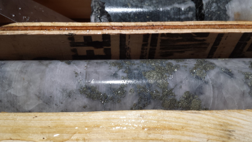
Ket 28 Geology and Prior Results

At the Ket28, Grizzly and other explorers have intersected anomalous gold associated with sulphide bearing silicified sediments, hornfels and skarn. The gold mineralization is associated with several structures at the edge of a strong positive ovoid aeromagnetic anomaly that is 2 km in length by 1 km in width and is likely indicative of an underlying intrusion. The Ket 28 target is approximately 13 km northwest of Kinross’ Buckhorn gold mine which is hosted in a pyroxene skarn south of the Canada-US border.

Historic exploration in the 1990’s by other explorers at the Ket 28 prospect, which is located within the Rock Creek claim group of the Greenwood Project, yielded high grade gold including up to 52.19 grams per tonne of gold (“g/t Au”) over 3.35 m core length. Drilling by Grizzly in 2009 and 2010 at the Ket 28 target following up the historic drilling in the mid 1990`s yielded up to 2.77 g/t Au over 11 m core length and 8.75 g/t Au over 3 m with a higher grade zone of 11.90 g/t Au over 2 m core length. Wider intervals of lower grade mineralization were also intersected as well with 1.02 g/t Au over 13.5 m core length and 1.19 g/t Au over 10.35 m core length. The gold mineralization intersected by prior explorers and Grizzly is considered open along strike and to depth.

The Company has submitted an application to the BC Ministry of Mines to conduct drilling and other exploration at the Ket 28 target with approximately 2,500 m in 10 to 12 drill holes planned for 2018. The proposed drill program will target the gold-prospective zone in the central portion of the Ket 28 target area, with the intention of developing a maiden mineral resource estimate and expanding the currently defined limits of gold mineralization. The initial Ket 28 drill program is expected to cost approximately $500,000 and is subject to financing.

Motherlode Geology and Prior Results

North of the historic Motherlode mine, drilling of a coincident magnetic and electromagnetic anomaly in 2011 yielded a new gold discovery with the intersection of 1.56 g/t Au and 11.12 g/t silver (Ag) across 19.0 m core length with a high grade zone of 17.15 g/t Au, 41.7 g/t Ag, 0.56% lead (Pb) and 1.51% zinc (Zn) across 1.5 m core length in hole 11ML03. Drillhole 11ML05, collared 40 m northeast of 11ML03, yielded similar results, with 1.64 g/t Au and 3.15 g/t Ag across 14.85 m core length with a higher grade zone of 6.79 g/t Au, 11.1 g/t Ag and 1.04% Zn across 1.5 m core length. Hole 11ML04, drilled beneath 11ML03, yielded 0.51 g/t Au and 1.02 g/t Ag over 13.5 m core length with a higher grade zone of 3.43 g/t Au, 2.90 g/t Ag and 0.8% Zn over 1.5 m core length.

The Au-Ag-Zn-Pb intersections in drillholes 11ML03, 11ML04 and 11ML05 are associated with fine grained pyrite, sphalerite and galena in chlorite-biotite altered hornfelsed late Paleozoic to Triassic sedimentary rocks adjacent to a small alkalic intrusion. Breccia zones and silicification are common in the hornfels zone. Small sections of marble and skarn with elevated precious and base metals were intersected in all three holes. Further drilling is being planned for the Motherlode North discovery. The Company has submitted an application to the BC Ministry of Mines to conduct drilling and other exploration at the Motherlode North target area.

Dayton Geology and Prior Results

Grizzly’s Greenwood Property is considered highly prospective for the presence of copper porphyries similar to those which have recently been discovered in northwestern and central British Columbia. A recent strategic review has identified a number of prospects that have geological characteristics and, in some cases, mineralization that is indicative of copper porphyry style mineralization. The Dayton prospect, on which exploration was conducted by the Company between 2009 and 2011 including drilling, yielded strong evidence of copper-gold porphyry style mineralization.

A total of 1,021 soil samples indicated a strong northwest-trending copper-gold anomaly approximately 450 m by 200 m with more than 100 of the samples containing from 100 parts per million (ppm) copper (Cu) up to 1,225 ppm Cu, along with 40 samples containing greater than 50 parts per billion Au. Surface mapping in the area identified a number of occurrences of pyrite and chalcopyrite, locally associated with high Cu and Au grades, in association with strongly hornfelsed volcanics, sediments and alkaline intrusions, along with local skarn. An Induced Polarization survey identified a number of high quality positive chargeability anomalies, a couple of which are associated with the soil anomaly.

A drilling program conducted in 2010 intersected up to 0.03% Cu and 0.18 g/t Au over 96 m of core length, including a higher grade zone of 0.38% copper equivalent (CuEq) over 8.1 m core length. In subsequent drilling conducted in 2011, a second eastern IP anomaly with a weak associated Cu-Au soil anomaly was drill tested and yielded 0.22% CuEq over 117 m of core length, with a high grade zone of 0.42% CuEq (0.15% Cu, 0.43 g/t Au and 0.81 g/t Ag) over 51 m near the top of the hole. These drill holes intersected the Cu-Au-Ag mineralization in large alteration and breccia zone with grades that compare favourably to the reported grades for a number of recently discovered Cu porphyries in northwest BC.

Potential for Cobalt Mineralization

During late 2017, the Company performed an initial review to see if its land holdings were prospective for the presence of cobalt (Co). The strategic review identified the presence of at least 13 rock grab samples with greater than 0.05%, including up to 0.10% Co, from at least five separate target occurrences across the eastern half of Grizzly’s Project area. The database shows an additional 31 rock grab samples that have yielded assays of between 0.02 and 0.05% Co. Maps showing the anomalous values and locations for Co at the Project are provided on the Company’s website by clicking the following link: Grizzly Discoveries Cobalt Maps:
http://www.grizzlydiscoveries.com/index.php/projects/bc-precious-metals/greenwood-cobalt

A preliminary review of the sample database indicates that many of the rock samples with anomalous Co also contain anomalous values for Cu and precious metals including Au and Ag. In many cases, the samples with anomalous Co were collected from Cu-enriched skarn and hornfels developed in Paleozoic sediments and intrusions, where the original sampling targeted precious metals. Grizzly has initiated a property wide review, including its extensive soil and drillhole database along with much of the historic data for the district that it has compiled over the years. The goal will be to target potential Co-Cu-Au-Ag mineralization associated with skarn across the district and come up with targets for follow-up exploration during summer and fall 2018.

Brian Testo, President and CEO of Grizzly, stated “We are excited that with the ongoing recovering of the mining sector during 2018, that we will now be able to push forward with our plans to expand the mineralization identified at Ket 28 and other targets in the Greenwood Project area. In addition, we look forward to our phase 1 surface exploration program focused on cobalt.”

Warrant and Options Exercised

During the third fiscal quarter-to-date (beginning February 1, 2018), the Company has received gross proceeds of $132,075 from the exercise of 1,761,000 outstanding warrants issued in private placements in 2016 and 2017, each with an exercise price of $0.075 per common share. Additionally the Company has received gross proceeds of $10,000 pursuant to an optionee exercising 200,000 stock options with an exercise price of $0.05 per common share issued in 2017 under the Company’s stock option plan. The exercise of these warrants and options has resulted in the issuance of 1,961,000 common shares of the Grizzly.

ABOUT GRIZZLY DISCOVERIES INC.

Grizzly is a diversified Canadian mineral exploration company with its primary listing on the TSX Venture Exchange with 58.7 million shares issued, focused on developing significant Potash assets in Alberta and its precious metals properties in southeastern British Columbia. The Company holds, or has an interest in: metallic and industrial mineral permits for potash totaling more than 60,000 acres along the Alberta-Saskatchewan border; over 180,000 acres of precious-base metal properties in British Columbia; and more than 161,000 acres of properties which host diamondiferous kimberlites in the Buffalo Head Hills region of Alberta.

The technical content of this news release and the Company’s technical disclosure has been reviewed and approved by Michael B. Dufresne, M. Sc., P. Geol., P.Geo., who is the Qualified Person as defined by National Instrument 43-101 Standards of Disclosure for Mineral Projects.

On behalf of the Board,
Grizzly Discoveries Inc.

Brian Testo
President
(780) 693-2242

For further information, please visit our website at www.grizzlydiscoveries.com or contact Investor Relations:

Nancy Massicotte
IR PRO COMMUNICATIONS INC.
Tel: 604-507-3377
Toll Free: 1-866-503-3377
Email: [email protected]
www.irprocommunications.com


Explor $EXS.ca Intersects 4.830 g/t #Gold Over 2.5 Meters on East Bay Gold Property $EXN.ca $HBE.ca $OSK.ca

Posted by AGORACOM-JC at 9:29 AM on Monday, March 5th, 2018

Exs logo

  • Intersects 4.830 g/t Au Over 2.5 Meters on East Bay Gold Property
  • Exploration program has confirmed several interesting drill targets
  • Program consisted of a Phase III 3000 meter drill program

ROUYN-NORANDA, Quebec, March 05, 2018- Explor Resources Inc. (“Explor or the “Corporation”) (TSX-V:EXS)(OTCQB:EXSFF)(FRANKFURT:E1H1)(BE:E1H1) is pleased to announce the results of the East Bay Gold Property exploration program. The analysis of previous exploration by Cambior and the results of the previous exploration program completed by Explor (Press Release October 06, 2015) have confirmed several interesting drill targets. The exploration program consisted of a Phase III 3000 meter drill program.

  2017-2018 Diamond Drill Program on East Bay Property

This program is in line with the Corporation’s strategy of conducting exploration along the Porcupine Destor Fault Zone (PDFZ), where several notable gold deposits have been found in the past, including the Timmins mining camp which produced more than 80 million oz of gold. The Corporation now owns 11,005.9 ha of land along this section of the PDFZ. Explor’s East Bay property is contiguous and wraps around the western portion of the former Clifton Star’s Duparquet property as shown on the attached plan. The East Bay property is approximately 0.5 km west of the former Consolidated Beattie and Donchester Gold Mines.The former Consolidated Beattie and Donchester Gold Mines, produced over 1.0 million oz of gold between 1933 and 1956. The former Clifton Star in a previous press release announced (Press Release dated April 09, 2014) significant proven and probable reserves of 1,895,530 oz at 1.50 g/t Au and a measured and indicated resource of 1,127,972 oz at 1.48 g/t Au on their property.

The East Bay Gold Property is located to the west of the Consolidated Beattie and Donchester Gold Property and contiguous to the ground on which the former Clifton Star Resources Inc. intersected wide width of gold mineralization (Press Releases dated June 19 and June 6, 2013).

Drilling was aimed at four targets along the prolific Porcupine Destor fault zone, respectively in Duparquet and Hébécourt Townships and one target near the contact between the Hunter Mine Group and the Deguisier Formation. Three geophysical targets were drilled on the western portion of the property.  A geophysical target on the eastern part of the property and one in the northern part were drilled. A total of 8 drill holes were completed for a total of 3,443 meters and 1,262 core samples were sent to the lab and analyzed.

In Duparquet Township, a total of 7 holes were completed. The Drilling was focused on increasing our understanding of the mineralization as it is associated with the felsic and mafic rock types.  Gold mineralization appears to be associated with the deformed contacts of feldspar porphyry dyke or in the porphyry. The drill holes completed in the 2018 program were aimed at locating this and testing its contacts at depth. The drilling confirmed the presence of the porphyry, strong deformation and significant anomalous gold mineralization.

In Hébécourt Township, drilling in 2018 consisted of one hole to target a significant geophysical anomaly. The hole was completed to a depth of 483 meters in length.

General observations and results obtained in 2018 are summarized below:

Drill hole EB-17-01 was aimed at testing the projection of a felsic porphyry and an anomalous zone of gold and arsenopyrite (mineralisation of the Beattie gold mine) found during the 2017 summer’s sampling campaign. Several pyritic zones (up to 10%) have been identified in the first 100 meters in basaltic rocks with no significant results. The first quartz-feldspar porphyry (“QFP”) was intersected between 384.50 meters and 411.90 meters down hole. A value of 0.536 g/t Au over 0.90 meters was analyzed in mafic lavas containing arsenopyrite at the top of the QFP contact.

Drill hole EB-17-02 and EB-17-03 were designed to confirm and better understand copper and gold zones intersected by Noranda Exploration Ltd. in 1994 (best result: 100 g/t Au, 1.40% Cu over 0.45 meters). Significant zones of alterations were intersected in the rhyolites as well as in QFP with several anomalous gold zones (best result: 0.618 g/t Au over 1.5 meters).

The purpose of hole EB-18-04 was to verify the eastward extension (300 m) of two porphyry dykes south of the Destor-Porcupine deformation zone intersected in hole # POR-98-97 drilled by Cambior in 1998 (1.19 g/t Au over 5.90 meters and 0.669 g/t Au over 7.15 meters). The porphyry zones were not intersected and no significant values were intersected.

Holes EB-18-05 to EB-18-07 targeted the porphyry east of the Duparquet River. Hole EB-18-05 returned several anomalous gold zones with the two in the QFP intrusion: 0.328 g/t Au over 12 meters and 4.85 g/t over 2.5 meters. Hole EB-18-06, directly below hole EB-18-05 has also returned several anomalous gold zones: 0.236 g/t Au over 24 meters from 162 to 186 meters and 1.54 g/t Au over 1.5 meters in the sediments and 0.611 g/t Au over 11 meters from 268 to 279 meters in the porphyry. Hole EB-18-07, 100 meters to the east, has encountered no significant values.

Hole EB-18-08 aimed at the intersection of the porphyry zone west of the Duparquet River with a probable NNE-SSW shear zone. A value of 3.87 g/t Au over 0.68 meters was returned in a small band of ultramafic rocks.

With very few drill holes completed so far on the western portion of the property, there is insufficient geological information to clearly understand the complex local tectonics and the anomalous gold zones with confidence.  Because of the presence of sheared and altered felsic porphyries and widespread gold mineralization in the ultramafics, the complex tectonic environment, and of very encouraging results, further drilling is highly recommended.

Chris Dupont, President and Chief Executive Officer of Explor Resources Inc. commented: “We are extremely pleased with the East Bay property. Explor Resources is the owner of the largest contiguous land package in the Duparquet Mining Camp. This property completes a wraparound to the west and northwest of the structure hosting the Beattie-Donchester Mines. Explor believes that the structure continues onto the Explor ground. Very little substantive exploration has been completed on Explor’s East Bay Gold Property.”

Chris Dupont P.Eng is the qualified person responsible for the information contained in this release.

Explor Resources invites investors to visit our booth at the following conference:

Booth #2122 at the Investor Exchange of the PDAC 2018 located in the south building of the Metro Toronto Convention Center from March 4 to March 7, 2018.

The management team at Explor Resources Inc. looks forward to having you join us.

Explor Resources Inc. is a publicly listed company trading on the TSX Venture (EXS), on the OTCQB (EXSFF) and on the Frankfurt and Berlin Stock Exchanges (E1H1).

This Press Release was prepared by Explor. Neither the TSX Venture Exchange nor its Regulation Services Provider (as that term is defined in the Policies of the TSX Venture Exchange) has reviewed or accepts responsibility for the adequacy or accuracy of this release.

About Explor Resources Inc.
Explor Resources Inc. is a Canadian-based natural resources company with mineral holdings in Ontario, Québec, Saskatchewan and New Brunswick. Explor is currently focused on exploration in the Abitibi Greenstone Belt. The belt is found in both provinces of Ontario and Québec with approximately 33% in Ontario and 67% in Québec. The Belt has produced in excess of 180,000,000 ounces of gold and 450,000,000 tonnes of cu-zn ore over the last 100 years. The Corporation was continued under the laws of Alberta in 1986 and has had its main office in Québec since 2006.

Explor Resources Flagship project is the Timmins Porcupine West (TPW) Project located in the Porcupine mining camp, in the Province of Ontario. The TPW mineral resource (Press Release dated August 27, 2013) includes the following:

Open Pit Mineral Resources at a 0.30 g/t Au cut-off grade are as follows:     Indicated: 213,000 oz (4,283,000 tonnes at 1.55 g/t Au) Inferred: 77,000 oz (1,140,000 tonnes at 2.09 g/t Au)   Underground Mineral Resources at a 1.70 g/t Au cut-off grade are as follows:   Indicated: 396,000 oz (4,420,000 tonnes at 2.79 g/t Au) Inferred: 393,000 oz (5,185,000 tonnes at 2.36 g/t Au)This document may contain forward-looking statements relating to Explor’s operations or to the environment in which it operates. Such statements are based on operations, estimates, forecasts and projections. They are not guarantees of future performance and involve risks and uncertainties that are difficult to predict and may be beyond Explor’s control. A number of important factors could cause actual outcomes and results to differ materially from those expressed in forward-looking statements, including those set forth in other public filling. In addition, such statements relate to the date on which they are made. Consequently, undue reliance should not be placed on such forward-looking statements. Explor disclaims any intention or obligation to update or revise any forward-looking statements, whether as a result of new information, future events or otherwise, save and except as may be required by applicable securities laws.

For further information please contact:
Christian Dupont, President
Tel: 888-997-4630 or 819-797-4630
Fax: 819-797-1870
Website: www.explorresources.com
Email: [email protected]

A map accompanying this announcement is available at http://www.globenewswire.com/NewsRoom/AttachmentNg/b1a4caf5-95eb-40c7-83c1-87ab7f05c229