![]()
- Intersects 2.187% Copper Over 9.66 Meters
- Chester Property is known to contain both a copper deposit and a VMS deposit
- Copper deposit has an Open Pit resource with Measured & Indicated resource of 1,400,000 tonnes grading 1.38% Cu, 0.06% Zn & 3.5 g/t Ag and an inferred resource of 2,089,000 tonnes grading 1.26% Cu
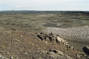
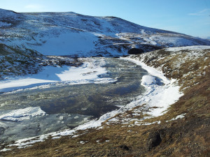
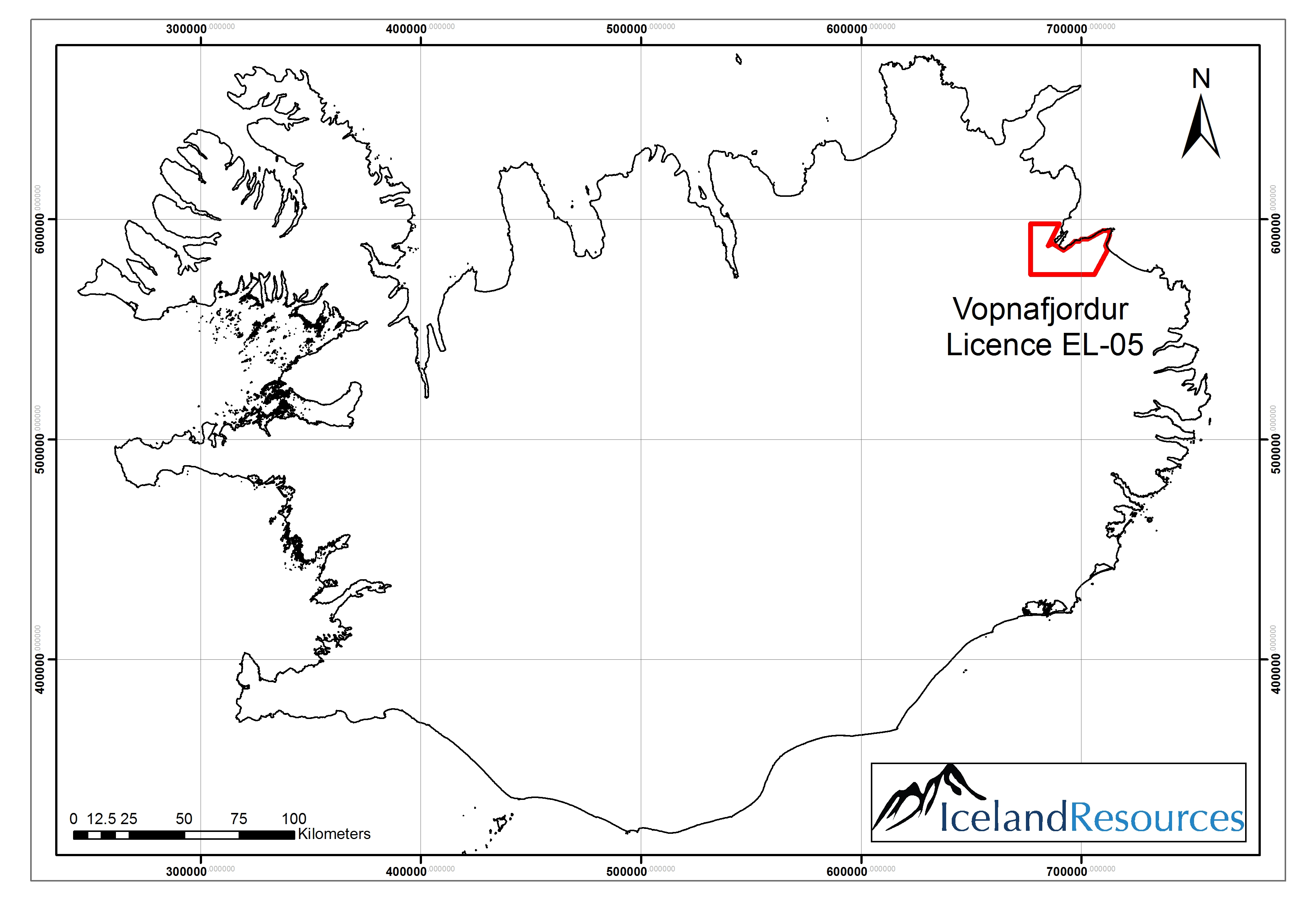
ROUYN-NORANDA, QUEBEC–(Nov. 30, 2016) – Explor Resources Inc. (“Explor” or the “Corporation“) (TSX VENTURE:EXS) (OTCQX:EXSFF) (FRANKFURT:E1H1) (BERLIN:E1H1)Â is pleased to announce the completion of 12 Diamond Drill Holes for a total of 2,027 meters on the Chester Copper Property. The Chester Copper property is located in the Northumberland County, 70 km southwest of Bathurst, New Brunswick and 50 km west-northwest of Miramichi, New Brunswick, within the Bathurst Mining Camp. This area has an extensive history in base metal production from VMS deposits.
There has been very little exploration work in this area of the Bathurst Mining Camp (BMC) since the initial exploration more than 60 years ago. Of significance also is the fact that three (3) age date studies of the rock in the area since 2005 have indicated an age of 469+/- 0.3 ma. All of the main largest VMS deposits in the BMC (including BMS #12 and #6, the Caribou Deposit (currently being developed by Travalli) and the past producing Heath Steele Mines, are associated with this age date for the footwall felsic rocks. That new data in 2007 places Explor’s Chester deposit is in the same time frame as the Brunswick Mining No. 12 and No. 6 deposits located in the BMC.
New Brunswick is the home of the No 12 massive sulphide deposit (The Brunswick Deposit) which was in continuous production from 1964 to its closure in March of 2013 (to Feb 2013, 135,903,168 tonnes milled at 3.44 % Pb, 8.74 % Zn, 0.37 % Cu and 102 g/t Ag). The Brunswick deposits (No 6 and No 12) are situated in the Nepisiguit Falls Group of rocks in the Lower Tetagouche group of the BMC. There are 46 known VMS deposits in the BMC.
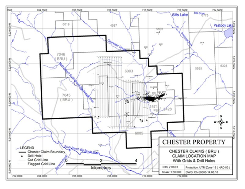
The property is located in the southern-most part of the Bathurst Mining Camp and consist of 174 Mineral Claim Units within a total of five (5) Mineral Claims (1571, 2428, 6003, 6005 and 7045) comprising approximately 3,828 hectares as shown on the attached map.
A total of 4 diamond drill holes were drilled on claim 1571. The first three diamond drill holes that were drilled were fan holes from the same location. This successfully tested the extension of the copper stringer zone for a distance of 190 meters west of previous drilling. The fourth drill hole was located approximately 100 meters west (and 38 meters south) of the first three drill holes, confirming the continuity of the mineralization to the west and adding 100 meters of strike length to the known deposit. It intersected the target horizon and favorable geology from 94 meters to 234.6 meters.
Further to the west the copper deposit goes down dip and onto claim 6003. At about 1,100 meters west of the first drill hole, drill hole 6003-16-012 was drilled at a vertical dip. It eventually went to a depth of 600 meters and intersected previously unknown mineralization near surface (18 meters) and also extending the deep main Chester Stringer zone an additional 650 meters westward than any previous reliable drilling (i.e. casing in place and core in government storage). It also confirms the existence of the alteration zone and the host stratigraphic horizon to a depth not previously known or expected. The chloritized favorable horizon extends from a depth of 472.5 meters to 561 meters with low grade copper mineralization documented from 519 meters to 543 meters.
In the north part of claim 6003, an untested soil geochemical anomaly was tested. Copper mineralization was discovered as pyrrhotite and chalcopyrite veinlets in felsic volcanic associated with the soil anomaly. Copper mineralization was also discovered in this area in 2014 and a soil survey on claim 7045 to the west have unexplained copper and lead anomalies which may be associated with previously mentioned soil anomaly and this horizon.
To the south on Claim 6005, two drill holes were put down to test a soil anomaly apparently associated with a historical drill hole, dating to about the 1956 to 1958 era, with a reported value of more than 2% copper. No indication of any mineralization was discovered in the two drill holes.
Preliminary results are shown below for Hole # 1571-16-001:
| Summary of results from Drill hole 1571-16-001: | ||||||||
| From (m): | To (m): | Length: (m) | Au (ppb) | Ag (ppm) | Cu % | Zn (ppm) | Pb (ppm) | |
| Zone 1 | 78.50 | 81.50 | 3.00 | 142 | 7.36 | 2.383 | 1708 | 138 |
| Zone 2 | 86.00 | 89.10 | 3.10 | 57.3 | 3.91 | 1.808 | 608 | 75 |
| Zone 3 | 119.00 | 122.55 | 3.55 | 113 | 6.65 | 7.973 | 932 | 86 |
| Zone 4 | 135.00 | 144.50 | 9.50 | 31 | 1.06 | 0.976 | 141 | 25 |
| includes: | 137.80 | 144.50 | 6.70 | 33 | 1.28 | 1.240 | 144 | 25 |
| and | 142.00 | 144.50 | 2.50 | 39 | 2.08 | 2.308 | 220 | 25 |
| Zone 5 | 153.00 | 162.66 | 9.66 | 84 | 1.93 | 2.187 | 198 | 36 |
| includes | 153.00 | 154.50 | 1.50 | 58 | 1.40 | 1.310 | 192 | 40 |
| and | 161.35 | 162.66 | 1.31 | 416 | 9.55 | 13.810 | 710 | 91 |
| Zone 6 | 177.80 | 179.70 | 1.90 | 72 | 3.31 | 2.323 | 346 | 62 |
A total of 6 zones of copper mineralization were intersected in the above referenced Hole # 1571-16-001 Samples have been sent to the lab and assays are pending.
The Chester Property is known to contain both a copper deposit and a VMS deposit. The copper deposit has an Open Pit resource with Measured & Indicated resource of 1,400,000 tonnes grading 1.38% Cu, 0.06% Zn & 3.5 g/t Ag and an inferred resource of 2,089,000 tonnes grading 1.26% Cu (assayed for Cu only).
Chris Dupont, P.Eng is the qualified person responsible for the information contained in this release.
Explor Resources Inc. is a publicly listed company trading on the TSX Venture (EXS), on the OTCQX (EXSFF) and on the Frankfurt and Berlin Stock Exchanges (E1H1).
This Press Release was prepared by Explor. Neither the TSX Venture Exchange nor its Regulation Services Provider (as that term is defined in the Policies of the TSX Venture Exchange) has reviewed or accepts responsibility for the adequacy or accuracy of this release.
About Explor Resources Inc.
Explor Resources Inc. is a Canadian-based natural resources company with mineral holdings in Ontario, Québec, Saskatchewan and New Brunswick. Explor is currently focused on exploration in the Abitibi Greenstone Belt. The belt is found in both provinces of Ontario and Québec with approximately 33% in Ontario and 67% in Québec. The Belt has produced in excess of 180,000,000 ounces of gold and 450,000,000 tonnes of cu-zn ore over the last 100 years. The Corporation was continued under the laws of Alberta in 1986 and has had its main office in Québec since 2006.
Explor Resources Flagship project is the Timmins Porcupine West (TPW) Project located in the Porcupine mining camp, in the Province of Ontario. Teck Resources Ltd. is currently conducting an exploration program as part of an earn-in on the TPW property. The TPW mineral resource (Press Release dated August 27, 2013) includes the following:
Open Pit Mineral Resources at a 0.30 g/t Au cut-off grade are as follows:
| Indicated: | 213,000 oz (4,283,000 tonnes at 1.55 g/t Au) | |
| Inferred: | 77,000 oz (1,140,000 tonnes at 2.09 g/t Au) |
Underground Mineral Resources at a 1.70 g/t Au cut-off grade are as follows:
| Indicated: | 396,000 oz (4,420,000 tonnes at 2.79 g/t Au) | |
| Inferred: | 393,000 oz (5,185,000 tonnes at 2.36 g/t Au) |
This document may contain forward-looking statements relating to Explor’s operations or to the environment in which it operates. Such statements are based on operations, estimates, forecasts and projections. They are not guarantees of future performance and involve risks and uncertainties that are difficult to predict and may be beyond Explor’s control. A number of important factors could cause actual outcomes and results to differ materially from those expressed in forward-looking statements, including those set forth in other public filling. In addition, such statements relate to the date on which they are made. Consequently, undue reliance should not be placed on such forward-looking statements. Explor disclaims any intention or obligation to update or revise any forward-looking statements, whether as a result of new information, future events or otherwise, save and except as may be required by applicable securities laws.
To view the image associated with this press release, please visit the following link: http://media3.marketwire.com/docs/CHESTERLRG.jpg
Christian Dupont
President
888-997-4630
819-797-1870
819-797-4630
[email protected]
www.explorresources.com


