- Completed the acquisition of Melmi EHF, the Icelandic corporation that owned the majority interest in the Thor Gold Project
- Acquisition allows St-Georges to control its destiny and plan its exploration campaigns with no interference
Reykjavik – TheNewswire – October 26, 2020 – St-Georges Eco-Mining Corp. (CSE:SX) (CNSX:SX.CN)(OTC:SXOOF) (FSE:85G1) is pleased to report that it has completed the acquisition of Melmi EHF, the Icelandic corporation that owned the majority interest in the Thor Gold Project and the remainder or the Icelandic mineral licenses not already controlled by St-Georges.
This transformative acquisition gives total control over the mineral licenses of the Republic of Iceland to St-Georges, making it the only junior exploration company to own all the mineral rights of a western country. This acquisition allows St-Georges to control its destiny and plan its exploration campaigns with no interference. It also gives the Company’s geological team access to extensive libraries of geological data, a large number of historical mineral samples and a well-maintained and secured national core shack that will be useable for future development. Furthermore, all the diamond drill cores from the Thor Gold project are now in the Company’s ownership and possession. The Company expects to be able to resample these cores in the process of elaborating its maiden NI 43-101 Gold-Silver and Copper resource estimate on the Thor Gold Project.
The Melmi EHF Acquisition
As previously disclosed in a press release on July 2, the Corporation will pay up to CA$775,000 in consideration of all the Melmi EHF shares as follows:
- (i)pay $65,000 upon the execution of the definitive share purchase agreement (the “Definitive Agreement”)
- (ii)pay an additional $60,000 on the earlier of: (a) 90 days of execution of the Definitive Agreement; and (b) the start of drilling on the Thor Gold Project;
- (iii)issue $400,000 of non-transferable debentures of the Corporation bearing a 6% annual interest, maturing 3 years from issuance (the “Maturity Date”), of $100,000 will be convertible into common shares in the capital of SX (the “SX Shares”) at a deemed price of $0.10 per SX Shares, $150,000 at a deemed price of $0.15 per SX Shares, and $150,000 at a deemed price of $0.20 per SX Shares; and
- (iv) as additional consideration, subject to and upon all the Licences Application having been granted, issue $250,000 non-transferable debentures of SX bearing a 6% annual interest, maturing 3 years from issuance, and convertible into SX Shares at a deemed price of $0.20 per SX Shares.
Iceland Operational Update
In September, the Corporation drilled a reversed circulation (RC) drill hole for a total length of 124 meters.
In October, reconnaissance and follow-up fieldwork was conducted in Vopnafjordur (Vopna) and Trollaskagi (Trolla) projects. Mineralization bearing outcrops were identified and sampled and brought to St-Georges’ secure facilities in Reykjavik for petrographic analysis. Some of the
se samples were prepared to be sent for assays to ALS Laboratories in Dublin, Ireland. Management expects that the results of these essays will become available later this year, and the Company expects to report on it as soon as the information becomes available.
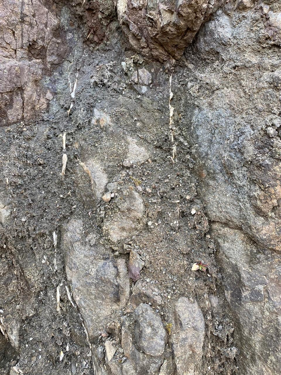
Picture 1, Outcrop on Trolla Gold Project
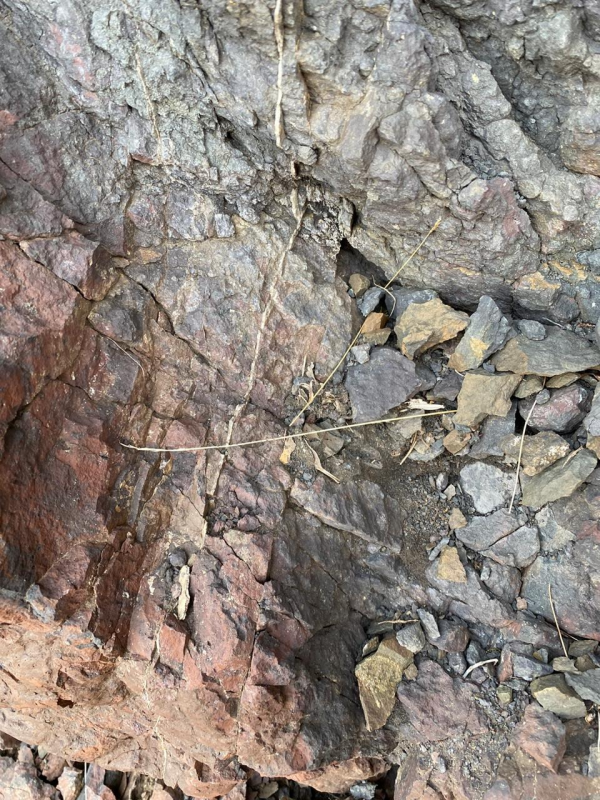
Picture 2. Outcrop on Trolla Gold Project
Picture 3. Close up of a Quartz Vein from an Outcrop on Trolla
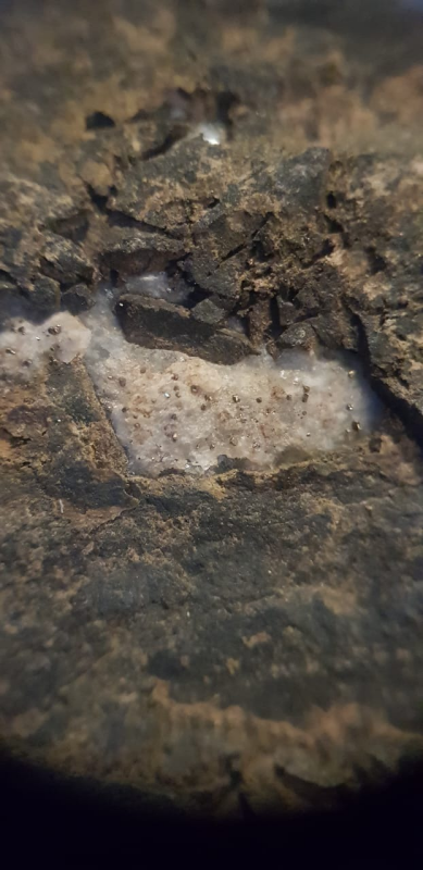
Picture 4 & 5: Quartz Vein from Trolla Outcrop (Picture 3) Under Magnifying glass (10X)
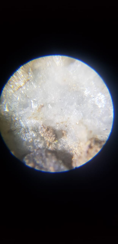
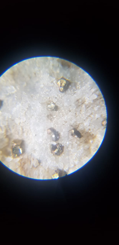
Picture 5. Magnified Quartz vein from Trolla Outcrop gold is associated with pyrite in Iceland
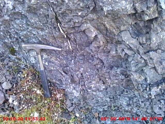
Picture 6. Outcrop at Trolla Gold Project
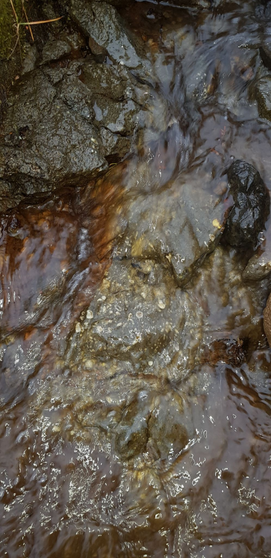
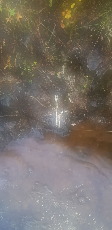
Picture 7. Water Stream over Outcrop at Vopna Gold.
About Iceland
Iceland climate, location, access and infrastructure (Histed,R,2010)
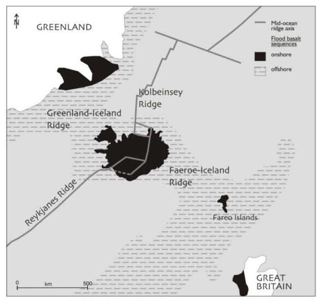
Located in the North Atlantic, approximately midway between Greenland and Great Britain, the warm North Atlantic Current ensures that the climate in Iceland, described as subpolar, oceanic, has generally higher temperatures than locations of similar latitude throughout the world. Regions or places that have similar climate are Tierra del Fuego, the Aleutian Islands and Alaskan Peninsula. Although Iceland lies close to the Arctic, its coasts remain ice-free year-round.
As can be expected, the southern coast is generally warmer, wetter and windier than the northern coast. The lower-lying, inland areas in the north are the most arid, although snowfall in the north during the winter months is greater than in the south.
Historically, recorded temperature extremes for the country are 30.5 C and -38.0C. The high in Reykjavik was 26.2C in 2008, and the low there was -24.5C in 1918. Although the Icelandic climate can be harsh, the GI-Melmi JV completed a drilling program at Thormodsdalur (Thor Gold Project) from November 2005 through May 2006 without undue difficulty. In the north, the increased snowfall would make an effort such as this more difficult. Reconnaissance is to be limited to the summer months.
Iceland’s infrastructure is well developed and modern. Road construction was begun around the start of the 20th century and peaked during the 1980’s. The roads are well constructed and maintained asphalt, although some gravel roads are still found. The current road system connects most of the larger towns and villages and is mostly confined to the coastal areas. Currently, there are a total of 12,691 kilometers of roads in Iceland that includes 3,262 kilometers of paved surface. Inland road access diminishes to dirt roads to no roads making access to some areas difficult, requiring foot travel or helicopter support. There are no railroads in Iceland.
Geological Setting
Iceland occurs at the junction of two large physical structures; the Mid Atlantic Ridge and the Greenland-Iceland-Faeroes Ridge (Figure 9). At this intersection, the mantle is hotter and less dense than the surrounding mantle. The mantle material rises as a result of heat and chemical-related density differences resulting in a dome in the crust above. This hotspot is causing a higher rate of extrusive volcanism at this point on the Mid Atlantic Ridge, which has, in turn, caused the region to be built up to a level more than 3 kilometers above the surrounding seafloor and covers an area of more than 350,000 km2. This is known as the Iceland Basalt Plateau. The portion of the plateau above sea level is now the country of Iceland (Martin, et al., 2007).
Tectonic Setting
In the Mid Atlantic Rift environment, the central portions of Iceland have moved outwards, away from the zones of active rifting and crustal development such that oldest rocks occur towards the margins and youngest in the center. Due to the migration of the hotspot to the south-east with time, an asymmetry has been imparted to the shape of the island. Currently, the hotspot lies under the south-eastern quadrant of the island (Corbett, 2004). This area now denotes the zone of active rifting and volcanism. Figure 10 shows the geology of Iceland defined by tectonic zones that coincide with the ages of the rocks.
Principal Tectonic Zones
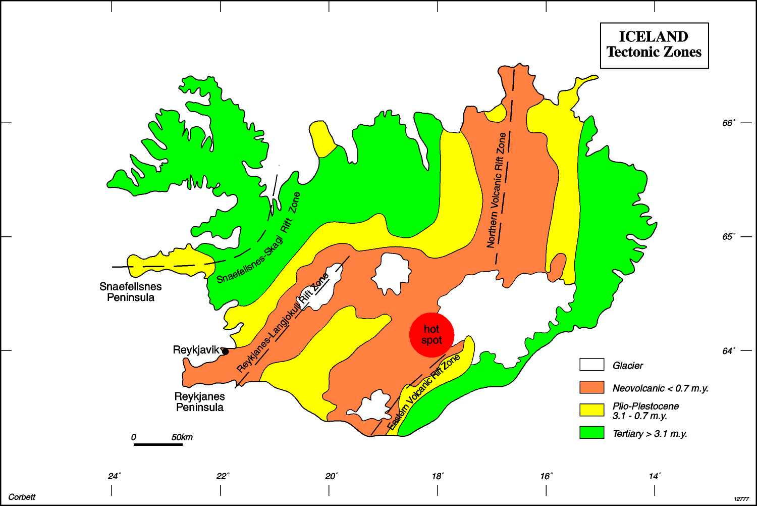
The significant rift systems that have focused volcanism through time are noted below.
- – The Snaefellsnes-Skagi Rift Zone in western Iceland was active in the 16-6.5 m.y. period. – The Reykjanes-Langjokull Rift Zone in central western Iceland resulted in the development of the Reykjanes Peninsula from about 6 my. – The North Volcanic Rift Zone became active from 3-4 my and extends to the present time. – An Eastern Volcanic Rift Zone is developing at this time.
Significant quantities of felsic intrusive and extrusive rocks occur in the dominantly basaltic sequence, and the felsic rocks locally display gold-anomalous hydrothermal alteration (Corbett, 2004).
Structurally, NE fractures reflect the spreading centre direction and are, therefore, some of the most numerous and laterally extensive fracture patterns, commonly evident as normal faults that may be exploited by dykes. NS and ENE fractures are developed as conjugate fractures during the NW-SE extension.