Agoracom Blog Home

Posts Tagged ‘zinc’

Tartisan Resources Corp. Announces  Private Placement  of 2 Million Units at 15 Cents per Unit $TTC.ca

Posted by AGORACOM-JC at 8:52 AM on Thursday, April 27th, 2017

Tartisan logo copy

  • Raising  $CDN 300,000 via a non-brokered private-placement of 2,000,000 units at CDN $0.15 cents per unit with a full warrant at CDN $0.20 cents, expiring eighteen months from date of closing of this offering

Toronto, Ontario – Tartisan Resources Corp. (CSE: TTC) (“Tartisan”, or the “Company”) is pleased to announce a Private Placement of up to two million units at 15 cents per unit.

Private Placement

Tartisan Resources Corp. is raising  $CDN 300,000 via a non-brokered private-placement of 2,000,000 units at CDN $0.15 cents per unit with a full warrant at CDN $0.20 cents, expiring eighteen months from date of closing of this offering.

The net proceeds from this offering will be used for general working capital purposes and to acquire and further its interests in  properties and projects in Peru, in particular to initiate a work program on the 100% owned Don Pancho polymetallic zinc-lead-silver-manganese project located 105 kilometers north-northeast of Lima in the Province of Huaral, Department of Lima, Peru and to complete the acquisition of a 100% interest in the Ichuna copper-silver property in South Peru.

Tartisan Resources Corp. common shares are listed on the Canadian Securities Exchange (CSE:TTC). Currently, there are 71,064,345 shares outstanding (84,759,982 fully diluted).

For further information, please contact Mr. D. Mark Appleby, President & CEO and a Director of the Company, at 416-804-0280 ([email protected]). Additional information about Tartisan can be found at the Company’s website at www.tartisanresources.com or on SEDAR at www.sedar.com.

This news release may contain forward-looking statements including but not limited to comments regarding the timing and content of upcoming work programs, geological interpretations, receipt of property titles, potential mineral recovery processes, etc. Forward-looking statements address future events and conditions and therefore, involve inherent risks and uncertainties. Actual results may differ materially from those currently anticipated in such statements.

The Canadian Securities Exchange (operated by CNSX Markets Inc.) has neither approved nor disapproved of the contents of this press release)

To view this press release as a PDF file, click onto the following link:
public://news_release_pdf/TartisanApr272017.pdf

Source: Tartisan Resources Corp. (CSE:TTC)

Tartisan Announces Signing of a LOI for the Purchase of the Don Pancho Zinc-Lead-Silver Property in Peru $TTC.ca

Posted by AGORACOM-JC at 8:03 AM on Wednesday, February 22nd, 2017

Tartisan logo copy

  • letter of intent with Duran Ventures Inc. (V-DRV) for the purchase of the Don Pancho zinc-lead-silver property in Peru
  • Agreement with Duran to acquire 100% of the Don Pancho polymetallic zinc-lead-silver project located in the Department of Lima Peru, 110 kilometers north-northeast of Lima, comprising one concession of 600 hectares

Toronto, Ontario (FSCwire)Tartisan Resources Corp. (CSE: TTC) (“Tartisan”, or the “Company”) is pleased to announce the signing of a letter of intent with Duran Ventures Inc. (V-DRV) ( “Duran”) for the purchase of the Don Pancho zinc-lead-silver property in Peru.

Letter of Intent

Tartisan Resources Corp. has entered into an agreement with Duran to acquire 100% of the Don Pancho polymetallic zinc-lead-silver project located in the Department of Lima Peru, 110 kilometers north-northeast of Lima, comprising one concession of 600 hectares and is the subject of a NI 43-101 compliant Report prepared in December 2014 available for viewing on SEDAR.

The project is located in a prolific polymetallic mineral belt in central Peru with several operating mines in the area including the world class Iscaycruz and Yauliyacu polymetallic mines operated by Glencore-Xtrata Plc located 50 kilometers to the north-northwest. Trevali Mining Corporation’s Santander silver-lead- zinc mine is located 9 kilometers to the east and Buenaventura’s silver-lead-zinc Uchucchacua mine is located 63 kilometers to the north, (10 million ounces of silver produced in 2011). Infrastructure is considered excellent with ready access and a power line crossing the property en route to the Santander mine.

Don Pancho Project

Previous exploration on the property included an extensive surface mapping and sampling program, geophysics and a 2000 metre diamond drilling program of 6 holes conducted by a private Peruvian company.

Mapping and sampling shows an extensive NNW-SSE trending breccia zone measuring over 800 metres in length and 150 to 200 metres in width. There are numerous old workings and underground drifts located within this zone. The 2014 diamond drilling program shows large intersections of polymetallic mineralization, including 40 metres of 0.88% Zn, 0.40% Pb and 7.7 g/t Ag, 22.65 metres of 1.00% Zn, 0.26% Pb and 6.85 g/t Ag and 1.15 metres of 4.38% Zn, 3.25% Pb and 61.1 g/t Ag, (see Duran’s Press Release September 2, 2014). Surface sampling from the previous operator has revealed very interesting values, including 13.9 metres of 28.1 g/t Ag, 2.43% Pb, and 2.42% Zn, 2.8 metres of 28.1g/t Ag, 1.06% Pb, and 9.07% Zn and 13 metres of 8.38g/t Ag, 0.39% Pb, and 2.22% Zn. Sampling of underground workings in Yanapallaca area before the previous operators retuned 106 g/t Ag, 3.26% Pb and 17.56% Zn over 2.00 metres. (see 43-101 Technical Report on Don Pancho filed December 30th, 2014 on Sedar). Please note that the true width of the mineralization both on the surface and underground workings cannot yet be determined as the controls of the mineralization is yet to be fully understood.

A program of geophysics, diamond drilling and underground drifting is envisioned. Structural analysis on the geology suggests previous drilling did not properly test the potential of the property.

The Agreement will permit Tartisan to acquire a 100% undivided interest in the property by paying $50,000 and issuing 500,000 common shares by March 31, 2017. Upon completion of 5,000 metres of drilling and/or underground development a further 150,000 shares are payable and if a NI 43-101 compliant resource is published, a further 150,000 shares are payable and if the Company loses control of the project either by sale or joint-venture, a further 200,000 shares are payable. Duran will retain a 2% net smelter return royalty, of which half (1%) can be purchased by Tartisan for US$500,000.

Tartisan Resources Corp. common shares are listed on the Canadian Securities Exchange (CSE:TTC). Currently, there are 63,287,629 shares outstanding (82,759,982 fully diluted).

For further information on Tartisan, please contact Mr. D. Mark Appleby, President & CEO and a Director of the Company, at 416-804-0280 ([email protected]). Additional information about Tartisan can be found at the Company’s website at www.tartisanresources.com or on SEDAR at www.sedar.com. For further information on Duran, please contact Jeff Reeder at 647-302-3290 ([email protected]) or www.duranventuresinc.com

This news release may contain forward-looking statements including but not limited to comments regarding the timing and content of upcoming work programs, geological interpretations, receipt of property titles, potential mineral recovery processes, etc. Forward-looking statements address future events and conditions and therefore, involve inherent risks and uncertainties. Actual results may differ materially from those currently anticipated in such statements

The Canadian Securities Exchange (operated by CNSX Markets Inc.) has neither approved nor disapproved of the contents of this press release.

Jeff Reeder P.Geo. a qualified person in the context of NI 43-101 has reviewed and approved the technical content of this News Release
To view this press release as a PDF file, click onto the following link:
public://news_release_pdf/Tartisan02222017.pdf

Source: Tartisan Resources Corp. (CSE:TTC)

St-Georges to Acquire All Outstanding Shares of Iceland Resources EHF $SX.ca

Posted by AGORACOM-JC at 1:33 PM on Tuesday, November 22nd, 2016

Sx hub logo

  • Entered into a binding agreement with Iceland Resources ehf to acquire all its outstanding shares
  • Iceland Resources owns multiple polymetallic exploration & development projects in Iceland and has direct or indirect access to all active mineral tenure, claims and mineral leases in Iceland

Montreal, Quebec / November 22, 2016 – St-Georges Platinum and Base Metals Ltd. (CSE: SX)(OTC: SXOOF) (FSE: 85G1) is pleased to announce that it has entered into a binding agreement with Iceland Resources ehf to acquire all its outstanding shares. Iceland Resources owns multiple polymetallic exploration & development projects in Iceland and has direct or indirect access to all active mineral tenure, claims and mineral leases in Iceland.

The Opportunity

Iceland Resources ehf is a privately-owned Icelandic corporation with gold/silver/copper/cobalt/zinc projects in Iceland.

Iceland is an important producer and developer of geothermal energy. St-Georges management has been active over the last few years in Iceland with the goal of securing access to geothermal operations to test the development of technologies allowing the extraction of lithium and light minerals from the brines being pumped from the geothermal wells and for the extraction of a large variety of precious and base metals found in the mud rejected from the same operations.

Enrico Di Cesare, Director of St-Georges commented: “(…) With St-Georges focused on innovative extraction technologies and working on strategic alliances with several providers, this opportunity is exciting; it is an excellent platform to apply new technologies, monetize tailings and demonstrate our solutions which also address environmental issues. The focus is to economically recover precious and base metals and to provide an avenue for positive environmental remediation of the by-products. St-Georges is also looking at niche and value added products that this opportunity lends itself to.”

Terms of Acquisition

St-Georges will create a subsidiary that will become the owner of Iceland Resources. 40% of this subsidiary will be owned by the Iceland Resources shareholders and the remaining 60% will be owned by St-Georges. Additionally, St-Georges makes the following commitments:

-Issuing 6,000,000 common shares of St-Georges to Iceland shareholders with a 12-month escrow release schedule;

-Issuing a $350,000 debenture, bearing a 6% annual interest (cash or shares), maturing in November 2026 to be distributed to Iceland shareholders and some creditors; and

-$1,000,000 of expenditure on the Iceland assets over the next 24 months, including mineral exploration expenses and metallurgical process research & development.

Iceland Resources Projects

Iceland Resources currently has 9 defined mineral exploration and development projects in Iceland (8 licenses or license applications held directly and one within a Joint-Venture). Other opportunities are being sought after with the collaboration of St-Georges (with the possibility to deploy St-Georges technologies result from its R&D initiatives).

St-Georges intends to direct most of its efforts in the next 24 months to 3 priority projects:

Reykjanes Project (EL 01) (Au-Ag-Cu-Zn)

The 897.5 km2Reykjanes licence area is in close proximity to the capital Reykjavik and the international airport in the town of Keflavik and is supported by good transport infrastructure with main highways running through it. The project is prospective for gold, silver, copper, zinc and cobalt. The Company also plans to apply for licenses to evaluate the lithium potential of the geothermal brines present on the property.
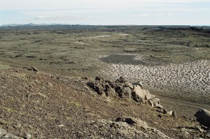
Figure 1. The Reykjanes Project

The Thormodsdalur Project (EL-14) (Au-Ag-Cu)

Thormodsdalur is located about 20km east of the city centre of Reykjavik and south-east of the lake Hafravatn. The project was discovered in 1908. The property produced mineral concentrate from 1911 to 1925 when over 300 meters of tunnels where dug alongside surface excavations. The ore recovered was transported to Germany and historic sources reported values ranging between 11g/t and 315g/t Au. Note: All information pertaining to mineral resources, grades or operational results herewith presented are historical in nature and while relevant, the information was obtained from sources that cannot be independently verified and that are not compliant with National Instrument 43-101 reporting standards.

More recently, visible gold was seen in cores from geothermal wells located on the project. This new discovery compelled the Icelandic government to create a mining entity for gold exploration in Iceland called Malmis.

Studies between 2005 and 2013 identified the project mineralization as a low sulphidation system containing banded chalcedony and ginguro. Petrographic analysis of the vein material identified gold occurring in its free form and as part of an assemblage with pyrite and chalcopyrite. Petrographic and XRD studies show an evolution of the vein system from the zeolite assemblage to quartz adularia and lastly to minor calcite. In the area, 32 holes have been drilled for a total of 2439 meters.Gold values vary from less than 0.5 ppm to the maximum of 415 ppm. (These values were obtained from selected random intervals and cannot be construed to be representative of the any particular thickness or overall length).

Iceland Resources entered in to a Joint Venture agreement with Melmi ehf, Malmis hf (majority government owned) and Gold Island Limited. Melmi is the owner of the Thormodsdalur license that was first granted in October 2004. Melmi is owned by Malmis (51%) and Gold Island (49%).
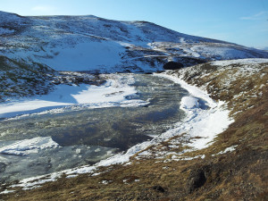
Figure 2. The Thormodsdalur Project

The Vopnafjordur Project (EL-05) (Au-Ag-Te) (Bi-Co-Sb-Se-Zn)

The Vopnafjordur licence covers 598.5 km2(Maps, fig. 3 & 4) and is valid until July 2021. Exploration in Vopnafjordur was carried out by Malmis between 1991 and 1993 in the form of BLEG surveys and vein sampling. Follow-up work was carried out by Melmi in 1997, which carried out stream sediment and helicopter-assisted rock chip sampling in the Vopnafjordur area. The rock chip sampling programme focused on areas of strong alteration, known quartz-carbonate-pyrite veining and in selected structural settings. The sampling programme indicated anomalous antimony, selenium and tellurium values in the northern rhyolitic centre and further identified anomalous gold, antimony, bismuth and zinc in an acid intrusion in the central southern part of the licence.

Recently, a comprehensive review of the BLEG and rock chip sampling programme was undertaken alongside satellite interpretation of the whole of the Vopnafjordur licence and a short exploration program in August 2016. In addition to the two volcanic centres identified in the 1990s, a number of regional fault zones associated with elevated levels of key pathfinder elements and occasionally gold was identified. The geological team is expecting assay results shortly.

These areas will be investigated further by the Company’s geological team in 2017, which will carry out close-spaced traverse mapping and grab sampling of key fault structures identified by previous exploration.
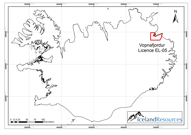

Click Image To View Full Size

Figure 3. Vopnafjordur licence EL-05 is situated in the Nord Austurland region of NE Iceland
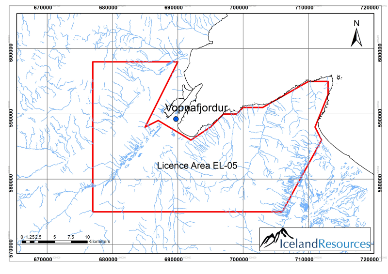

Click Image To View Full Size

Figure 4. Extent of Vopnafjordur licence boundaries. Map scale 1:200,000

Click Image To View Full Size

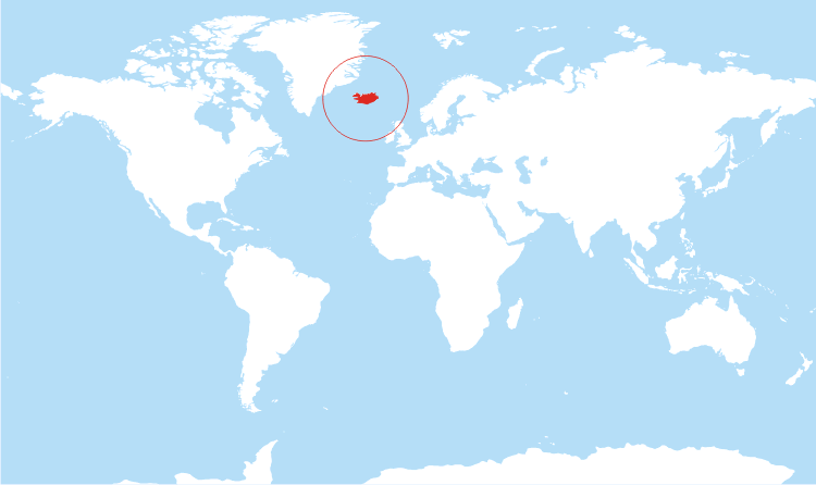
Figure 5. World map showing Iceland


Click Image To View Full Size

Figure 6. Map of Iceland with location of the projects

Icelandic Geology is unique and considered relatively young in geology term. Iceland lies in the divergent boundaries of the Mid Atlantic Ridge. The buoyancy of the Iceland plume leads to dynamic uplift of the Iceland plateau, and high volcanic productivity over the plume has developed an anomalous volume of volcanic material and magma chambers at depth.

Iceland has not been thoroughly mapped and geological exploration has been limited when compared to other jurisdictions. St-Georges now have the unencumbered opportunity to explore Iceland’s potential starting with its most known prospective target sites with data generated from existing geological work and geothermal operations around the country. Furthermore, St-Georges technologies should enable the team of Iceland Resources to unlock the potential for prospective lithium brines and mud tailings that were not considered in the past.

Vilhjalmur Thor Vilhjalmsson, director of Iceland Resources, commented: “The opportunity to combine the resources of both companies, our extensive knowledge of Iceland and its geology and the addition of St-Georges team’s expertise in metallurgical processing and eco-mining environmental friendly solutions, provides a unique offering to the market and stakeholders of both companies (…) St-Georges brings a portfolio of R&D initiatives aimed at reducing the environmental impact of mining activities and improving producers’ financial bottom line. Iceland like the Scandinavian countries is a place of certainty in regulations and mining law with reliable and accessible data available from government bodies thus opening possibilities to get additional licenses with historical data available similar to work previously done in Iceland as well as in Greenland (…) we believe that we found a good home for our shareholders in St-Georges and we are excited at the prospect of the proposed 2017 exploration and development campaigns.”

General Disclaimer: The current press release contains references to mineral sampling results that are provided by Iceland Resources or were sourced in the geological literature published by the Icelandic government or its departments. St-Georges has not sampled and analysed these samples. Readers should exercise caution as real width, depth or length of the mineralisation encounter is not defined. No resource estimate that is compliant with the standard of the National Instrument 43-101 is currently available.

The technical information in this release has been reviewed and approved by Mr. Herb Duerr, P. Geo. a ‘qualified person’ as defined by National Instrument 43-101Standards of Disclosure for Mineral Projects.

ON BEHALF OF THE BOARD OF DIRECTORS

“Frank Dumas’

FRANK DUMAS, PRESIDENT & CEO

About St-Georges

St-Georges is developing new technologies to solve the biggest environmental problems in the mining industry. If thesenew technologiesare successful, they should improve the financial bottom line of current mining producers. The potential success of these technologies would also involve upgrading certain current known metal resources to economic status while addressing the environmental and social acceptability issues. The Company also explores for Nickel on the Julie Nickel Project & for industrial minerals on the Quebec’s North Shore and for Lithium and rare metals in Northern Quebec and in the Abitibi area.Headquartered in Montreal, St-Georges’ stock is listed on the CSE under the symbol SX, on the US OTC under the Symbol SXOOF and on the Frankfurt Stock Exchange under the symbol 85G1. For additional information, please visit our website at www.stgeorgesplatinum.com

About Iceland Resources EHF

Iceland Resources ehf is a junior mineral exploration company with a focus on the Scandinavian region. The company has one licence in the Vopnafjordur area in Iceland and further seven areas pending issue totalling over 4,000km2. The company also has an earn-in agreement with Melmi ehf and Gold Island Ltd to earn into the well-known Thormodsdalur licence where gold grades up to 415 g/t have been identified and the partners are working towards a NI 43-101 compliant resource.http://www.icelandresources.is

The Canadian Securities Exchange (CSE) has not reviewed and does not accept responsibility for the adequacy or the accuracy of the contents of this release.

Explor Announces Kidd Township Property Diamond Drilling Results $EXS.ca

Posted by AGORACOM-JC at 12:43 PM on Tuesday, October 11th, 2016

Exs_logo

  • Announced the Diamond Drilling results on the Kidd Township Property
  • So encouraged by the initial results of the 3000 meter program that it decided to more than double the diamond drilling program planned to 7275.7 meters.
  • Intersected many of the ore bearing lithological units and marker horizons as within the Kidd Creek Mine.
  • Intersection of 4024 & 15,500 ppm Zn (over 1.1 & 1.0 meters respectively) within cherty tuffs and cherty-exhalite was very encouraging and suggests that both claim blocks may host a Kidd Creek Style Copper- Zinc deposit

ROUYN-NORANDA, QUÉBEC–(Oct. 11, 2016) – Explor Resources Inc. (“Explor” or “the Corporation”) (TSX VENTURE:EXS)(OTCQX:EXSFF)(FRANKFURT:E1H1)(BERLIN:E1H1) is pleased to announce the Diamond Drilling results on the Kidd Township Property. The Corporation’s Kidd Township Group of Properties are located to the North, South, West and East of the Glencore Kidd Creek Mine, located approximately 20 km north of Timmins, Ontario. Explor’s Kidd Township’s Group of Properties have a land position that covers an area of approximately 2,805.20 hectares. The most obvious topographical feature in the area is the Glencore Kidd Creek open pit mine, located in the central portion of Explor’s Kidd Township group of Properties. Explor was so encouraged by the initial results of the 3000 meter program that it decided to more than double the diamond drilling program planned to 7275.7 meters. Explor drilled seven holes & two wedges on three claim blocks, one being in Carnegie Township, northeast of the mine and the other two blocks drilled in Kidd Township, southwest of the mine.

The property is located in a Greenstone Belt composed mainly of sequences of Meta-Volcanic rocks cut by faults and deformation zones that lie in a NW-SE direction. There are many suites of Mafic Volcanic rocks as well. Excellent access to the property is provided by Hwy 655.

Exploration drilling completed by Explor to date has revealed Major Fault Structures running to the west and east of the Glencore Kidd Creek Mine in a NW-SE direction. A thorough review of all existing geophysical data appears to support these findings. Drilling by Falconbridge in 1998 to the southwest of the Glencore Kidd Creek Mine (Hole # K26-01) returned 4.7m in which 4 of the 5 samples returned Zinc values from 4200 – 8900 ppm and Copper values that ranged from 700 – 2280 ppm.

Holes KC-16-01, KC-16-02 and KC-16-05 were drilled in Kidd Township to intersect magnetic highs and fold structures approximately 3 kilometers south and south east of the Kidd Creek Mine. Holes 01, 02 and 05 were very encouraging as they intersected mostly graphitic argillite and felsic lapilli tuffs which are very important zinc-copper ore bearing rocks and marker horizons within the Kidd Creek Mine. Several samples returned anomalous Zinc values from 109 to 737 ppm mostly within sheared graphitic argillite.

Holes KC-16-03, KC-16-04, KC-16-06, KC-16-06A and wedges 06AW1 &06AW2 were drilled in Carnegie Township on the border with Kidd Township approximately 2 kilometers north of the Kidd Creek mine site. Holes KC-16-03 & 04 were drilled bearing south to intersect E-W trending geophysical conductors. Both holes intersected ultramafics, mafic fragmental, felsic to intermediated tuffs and exhalite-chert-tuff units. Hole KC-16-03 intersected several Zinc values from 140 to 15,500 ppm (1.5% Zn) (over 1.0 meters) within the exhalite-chert unit. Hole KC-16-04 was drilled to intersect the exhalite-chert unit up dip from hole KC-16-03. Hole 04 intersected ultramafics, intermediate tuffs, mafic fragmental, lapilli tuff and mafic pillowed flows. Several anomalous Zinc values were intersected, the best being 266 ppm. Hole KC-16-06 was drilled from the east to intersect the exhalite-chert unit down dip from hole KC-16-03. Hole KC-16-06A and its wedges 06AW1 & 06AW2 were completed to 1101 meters and intersected ultramafics and cherty tuffs. More importantly, hole-wedge KC-16-06AW2 intersected parts of the exhalite-chert unit down dip of KC-16-03 with several anomalous Zinc values from 114 to 4024 ppm.

The 2016 Kidd-Carnegie drill program was successful in that it intersected many of the ore bearing lithological units and marker horizons as within the Kidd Creek Mine. As well, the intersection of 4024 & 15,500 ppm Zn (over 1.1 & 1.0 meters respectively) within cherty tuffs and cherty-exhalite was very encouraging and suggests that both claim blocks may host a Kidd Creek Style Copper- Zinc deposit.

Chris Dupont, President and Chief Executive Officer of Explor Resources Inc. commented: “We are extremely pleased and encouraged by these preliminary drill results. The presence of exhalite-chert unit in two of the holes is very significant in terms of exploration. Generally exhalite-chert is proximal to a VMS deposit. This is the first time in our 10 years of exploration around the Kidd Creek mine site that exhalite-chert has been intersected. Explor plans on conducting in the near future a down hole geophysical survey that will see a 200 meter radius around the hole in order to further refine our diamond drilling. We expect to be able to wedge into any targets that are found.”

Explor believes in the “Cluster Effect of VMS (Volcanogenic Massive Sulfide) Deposits”. Well known examples of the cluster effect of VMS Deposits are the Bathurst Mining Camp where 47 deposits have been found to date, including the Brunswick No.12 and the Brunswick No.6 Mines where more than 130,000,000 tonnes of Base Metal Ore has been produced to date; and the Noranda Mining Camp where 18 deposits have been found to date, with 68,100,000 tons of Base Metal Production from the Horne Mine and Quemont Deposits alone. The Glencore Kidd Creek Mine located to the South-west of the property has produced 152,600,000 tonnes of Base Metal Ore (Cu-Zn-Pb-Ag) since it began production in 1966. The presence of Mafic and Felsic rocks on the Kidd Township Properties with anomalous zinc and copper supports the opinion that additional VMS Deposits exist in the immediate vicinity of the Glencore Kidd Creek Mine.

Chris Dupont, P.Eng is the qualified person responsible for the information contained in this release.

Explor Resources Inc. is a publicly listed company trading on the TSX Venture (EXS), on the OTCQX (EXSFF) and on the Frankfurt and Berlin Stock Exchanges (E1H1).

This Press Release was prepared by Explor. Neither the TSX Venture Exchange nor its Regulation Services Provider (as that term is defined in the Policies of the TSX Venture Exchange) has reviewed or accepts responsibility for the adequacy or accuracy of this release.

About Explor Resources Inc.

Explor Resources Inc. is a Canadian-based natural resources company with mineral holdings in Ontario, Québec, Saskatchewan and New Brunswick. Explor is currently focused on exploration in the Abitibi Greenstone Belt. The belt is found in both provinces of Ontario and Québec with approximately 33% in Ontario and 67% in Québec. The Belt has produced in excess of 180,000,000 ounces of gold and 450,000,000 tonnes of cu-zn ore over the last 100 years. The Corporation was continued under the laws of Alberta in 1986 and has had its main office in Québec since 2006.

Explor Resources Flagship project is the Timmins Porcupine West (TPW) Project located in the Porcupine mining camp, in the Province of Ontario. Teck Resources Ltd. is currently conducting an exploration program as part of an earn-in on the TPW property. The TPW mineral resource (Press Release dated August 27, 2013) includes the following:

Open Pit Mineral Resources at a 0.30 g/t Au cut-off grade are as follows:
Indicated: 213,000 oz (4,283,000 tonnes at 1.55 g/t Au)
Inferred: 77,000 oz (1,140,000 tonnes at 2.09 g/t Au)
Underground Mineral Resources at a 1.70 g/t Au cut-off grade are as follows:
Indicated: 396,000 oz (4,420,000 tonnes at 2.79 g/t Au)
Inferred: 393,000 oz (5,185,000 tonnes at 2.36 g/t Au)

This document may contain forward-looking statements relating to Explor’s operations or to the environment in which it operates. Such statements are based on operations, estimates, forecasts and projections. They are not guarantees of future performance and involve risks and uncertainties that are difficult to predict and may be beyond Explor’s control. A number of important factors could cause actual outcomes and results to differ materially from those expressed in forward-looking statements, including those set forth in other public filling. In addition, such statements relate to the date on which they are made. Consequently, undue reliance should not be placed on such forward-looking statements. Explor disclaims any intention or obligation to update or revise any forward-looking statements, whether as a result of new information, future events or otherwise, save and except as may be required by applicable securities laws.

A map is available at the following address: http://media3.marketwire.com/docs/161011_EXS_MAP.pdf

Explor Resources Inc.
Christian Dupont
President
819-797-6050
888-997-4630 or 819-797-4630
[email protected]
www.explorresources.com

Explor Announces Ogden Property Diamond Drilling Program

Posted by AGORACOM-JC at 4:19 PM on Tuesday, March 22nd, 2016

Exs_logo

  • Announced the commencement of a Diamond Drilling Program on the Ogden Gold Property
  • Consist of 8 mining claims (70 mineral claim units) covering 1,120 hectares situated in the Porcupine mining division, district of Cochrane, in the Ogden Township, Ontario
  • Claims are contiguous and to the east of the Timmins Porcupine West Property

ROUYN-NORANDA, QC–(March 22, 2016) – Explor Resources Inc. (“Explor” or “the Corporation”) (TSX VENTURE: EXS) (OTCQX: EXSFF) (FRANKFURT: E1H1) (BERLIN: E1H1) is pleased to announce the commencement of a Diamond Drilling Program on the Ogden Gold Property. The property is located 12 kilometers southwest of the city of Timmins, Ontario. The property consist of 8 mining claims (70 mineral claim units) covering 1,120 hectares situated in the Porcupine mining division, district of Cochrane, in the Ogden Township, Ontario. These claims are contiguous and to the east of the Timmins Porcupine West Property as shown on the attached map. Access to the property is via an all-weather road from Highway 101 to the west of the property.

The exploration program will consist of 3,000 meters of diamond drilling. This diamond drill program will concentrate on geophysical targets as identified by Explor’s recent ground geophysical survey and IP work conducted by Inmet and Knick Exploration. Analysis of existing geophysical data along with Explor’s recently completed work has revealed a major geological structure similar to the one located on Explor’s Timmins Porcupine West Gold Property. It would appear to be a continuation of the Bristol Porphyry on the other side of the Mattagami River fault. Previous reconnaissance exploration work by Inmet Mines defined several induced polarization anomalies (1997) and these are incorporated with recent I.P. survey data as the surveys were completed by the same service company and all original data has been acquired by Explor Resources.

The property has been previously explored by Hollinger Mines, Tex-Sol Exploration, Inmet Mining Corporation, Amax Mineral Exploration, Noranda Exploration and Knick Exploration. The majority of the holes drilled by previous operators were less than 100 meters in length. Historically on the Ogden Property, the only hole that hit significant mineralization was a diamond drill hole by Tex-Sol Exploration in 1965 which returned 6.0 g/t Au over 9.1 m at a shallow depth. On the TPW Gold Property significant mineralization was intersected below 300 meters of vertical depth requiring drill holes of 500 to 600 m in length.

The most significant deposits in Timmins are spatially associated with porphyry units that are in proximity to the Porcupine Destor Fault. The deposits appear to be also associated with splay faults that trend off and to the North of the Porcupine Destor fault inside an interpreted splay fault corridor.

The Ogden Property is contiguous on the east side of the Timmins Porcupine West Property. The Timmins Porcupine West Project has as a Target Model “The Hollinger-McIntyre-Coniaurum System.” The Hollinger-McIntyre-Coniaurum (HMC) System has produced a total of over 30 million oz of gold is spatially associated with the Pearl Lake Porphyry. The high-grade gold bearing quartz veins which hosted the bulk of the gold at the HMC occurred in the adjacent mafic volcanics, located outboard from the porphyry itself.

Chris Dupont P.Eng is the qualified person responsible for the information contained in this release.

Explor Resources Inc. is a publicly listed company trading on the TSX Venture (EXS), on the OTCQX (EXSFF) and on the Frankfurt and Berlin Stock Exchanges (E1H1).

This Press Release was prepared by Explor. Neither the TSX Venture Exchange nor its Regulation Services Provider (as that term is defined in the Policies of the TSX Venture Exchange) has reviewed or accepts responsibility for the adequacy or accuracy of this release.

About Explor Resources Inc.

Explor Resources Inc. is a Canadian-based natural resources company with mineral holdings in Ontario, Québec, Saskatchewan and New Brunswick. Explor is currently focused on exploration in the Abitibi Greenstone Belt. The belt is found in both provinces of Ontario and Québec with approximately 33% in Ontario and 67% in Québec. The Belt has produced in excess of 180,000,000 ounces of gold and 450,000,000 tonnes of cu-zn ore over the last 100 years. The Corporation was continued under the laws of Alberta in 1986 and has had its main office in Québec since 2006.

Explor Resources Flagship project is the Timmins Porcupine West (TPW) Project located in the Porcupine mining camp, in the Province of Ontario. Teck Resources Ltd. is currently conducting an exploration program as part of an earn-in on the TPW property. The TPW mineral resource (Press Release dated August 27, 2013) includes the following:

Open Pit Mineral Resources at a 0.30 g/t Au cut-off grade are as follows:

Indicated: 213,000 oz (4,283,000 tonnes at 1.55 g/t Au)
Inferred: 77,000 oz (1,140,000 tonnes at 2.09 g/t Au)

Underground Mineral Resources at a 1.70 g/t Au cut-off grade are as follows:

Indicated: 396,000 oz (4,420,000 tonnes at 2.79 g/t Au)
Inferred: 393,000 oz (5,185,000 tonnes at 2.36 g/t Au)

This document may contain forward-looking statements relating to Explor’s operations or to the environment in which it operates. Such statements are based on operations, estimates, forecasts and projections. They are not guarantees of future performance and involve risks and uncertainties that are difficult to predict and may be beyond Explor’s control. A number of important factors could cause actual outcomes and results to differ materially from those expressed in forward-looking statements, including those set forth in other public filling. In addition, such statements relate to the date on which they are made. Consequently, undue reliance should not be placed on such forward-looking statements. Explor disclaims any intention or obligation to update or revise any forward-looking statements, whether as a result of new information, future events or otherwise, save and except as may be required by applicable securities laws.

Image Available: http://www.marketwire.com/library/MwGo/2016/3/22/11G088665/Images/zz-68a5c2d7e88582b4afeeada2bec0cf63.jpg

For further information please contact:

Christian Dupont
President
Tel: 888-997-4630 or 819-797-4630
Fax: 819-797-6050
Website: www.explorresources.com
Email: [email protected]

Donner Metals Ltd.: Mcleod Zone Extended Up-Dip: Exploration Drilling Intersects 2.83% Copper, 13.09 g/t Silver and 0.13 g/t Gold Over 19.35 Metres

Posted by AGORACOM-JC at 9:20 AM on Wednesday, September 19th, 2012

VANCOUVER, BRITISH COLUMBIA–(Sept. 19, 2012) – Mr. Harvey Keats, Chief Executive Officer of Donner Metals Ltd. (TSX VENTURE:DON)(FRANKFURT:D4M) reports on exploration results for drilling conducted in the vicinity of the Bracemac-McLeod Deposit and within the 4,737 square kilometre Matagami Project as reported to the Company by partner and project operator Xstrata Canada Corporation-Xstrata Zinc Canada Division (“Xstrata Zinc”). Renewed exploration diamond drilling up-dip from the McLeod Zone has discovered new copper mineralization within a laterally extensive chlorite alteration zone, including 2.83% copper over 19.35 metres intersected in hole MCL-12-16, drilled 45 metres up-dip from previous drilling on the McLeod Zone. Two drills are currently active on the project.

Results from each area are described below and assay results are listed in the attached Table 1. To view Table 1 and a longitudinal cross section, please visit the following link: http://media3.marketwire.com/docs/don919ei.pdf.

McLeod Up-Dip

A broad zone of mineralized chlorite alteration (“Pipe” alteration) with copper-bearing massive and semi-massive sulphides was intersected up-dip from current Mineral Reserves in the McLeod Zone. Eleven diamond drill holes were targeted on the Key Tuffite horizon at an average spacing of approximately 50 metres and covering an area measuring approximately 200 by 200 metres along the up-dip trend of the McLeod alteration system (Figure 1). This system is now known to extend over 1.4 kilometres in length and 400 metres in width. It hosts Proven and Probable Mineral Reserves in the McLeod Zone, Indicated Mineral Resources in the Copper Stringer Zone and Inferred Mineral Resources in both the McLeod Deep and West McLeod zones. Mineralization reported below is new and extends the known mineralization within the up-dip portion of this trend. Significant exploration potential remains to be investigated in the McLeod alteration system and adjacent to its known sulfide deposits.

Diamond drill holes MCL-12-15 and MCL-12-16 intersected sulphide mineralization at the Key Tuffite horizon over appreciable drilled widths along the southeastern margin of the McLeod alteration trend. MCL-12-15 returned 0.16% zinc, 2.06% copper, 7.00 g/t silver and 0.07 g/t gold over 4.00 metres. MCL-12-16, located 47 metres down- dip from MCL-12-15 and 45 metres up-dip from previous McLeod Zone drilling, intersected 0.14% zinc, 2.83% copper, 13.09 g/t silver and 0.13 g/t gold over 19.35 metres. MCL-12-14 was drilled a further 62 metres up-dip from MCL-12-15 and returned stringer mineralization in the hanging wall to the Key Tuffite. Drill hole MCL-12-18, drilled 33 metres southwest and down-dip from MCL-12-16, intersected weak chalcopyrite stringers intermittently over 11.6 metres in the immediate footwall to the Key Tuffite. Mineralization encountered in holes MCL-12-15 and MCL-12-16 remains to be investigated to the southeast.

In the Key Tuffite horizon immediately northwest of the intersections listed above, diamond drill holes MCL-12-08, MCL-12-09, and MCL-12-11 intersected significant copper values over narrow widths, while drill hole MCL-12-12 intersected 0.50% zinc, 2.13% copper, 7.19 g/t silver and 0.17 g/t gold over 7.00 metres. Drill hole MCL-12-09 also intersected a mineralized sequence within the Pipe alteration in the hanging wall above the Key Tuffite. Drill holes MCL-12-13 and MCL-12-14 intersected minor amounts of sulphide mineralization within Pipe alteration zones. Hole MCL-12-17 was drilled laterally across the alteration trend specifically to test a vertically-dipping, north-south trending structure. It intersected a felsic dyke at the Key Tuffite horizon.

Bracemac: Underground Exploration

Three exploration drill holes were completed from underground development that accesses the Bracemac Main Zone. The program was designed to test the Key Tuffite horizon in the vicinity of historical drill hole DDH-33EXT, which intersected well-mineralized Key Tuffite over 3 metres, including massive sulphides that graded 38.09% zinc over 0.15 metres. The location of this intersection is 350 metres northwest of the Bracemac KT Zone in an area where drill spacing is on the order of 100 to 360 metres. Drill hole UBRC-048 and UBRC-048A intersected the Key Tuffite 120 metres southeast of DDH-33EXT where they encountered sulphide mineralization and chlorite alteration at the Key Tuffite. UBRC-048 intersected massive, semi-massive and stringer sulphides (pyrite and lesser sphalerite) from 195.70 to 198.60 metres and similar stringer and laminated sulphides from 207.00 to 213.70 metres. Chlorite alteration with both disseminated and stringer sphalerite occurred in both the hanging wall and footwall to these intervals. UBRC-048A was drilled 6 metres southeast of UBRC-048 and intersected the Key Tuffite, containing stringer and laminated pyrite and sphalerite, from 194.5 to 202.8 metres. Rocks in the footwall to this interval exhibited well-developed chlorite alteration and disseminated sphalerite. Drill hole UBRC-049 intersected disseminated sphalerite mineralization over 0.3 metres. This intersection is located 20 metres northeast of DDH- 33EXT at the Key Tuffite. There is remaining exploration potential in the vicinity of the Bracemac zones at both the Key Tuffite and the Bracemac stratigraphic levels.

Galinée 14 Area

Two diamond drill holes were completed at the Galin̩e 14 Prospect located 6.5 kilometres southeast of the Bracemac-McLeod mine. Both holes intersected significant widths of Pipe alteration within the Key Tuffite РWatson Lake sequence with one hole returning the first appreciable sign of sulphide mineralization. Drill hole GAL14-12-10 returned 1.00% zinc, 0.15% copper, 0.66 g/t silver and 0.01 g/t gold over 7.50 metres within the alteration package. Drill hole GAL14-12-11 intersected unmineralized Pipe alteration. The Galin̩e 14 alteration system is one of the largest areas of continuous Pipe alteration in the Matagami Camp and it remains open for further investigation.

Rivière Allard

One drill hole was completed in the Rivière Allard area in the Central Camp Joint Venture area approximately 11 kilometres from the Matagami Lake Mill. Drill hole RA-12-11 intersected mineralized intermediate intrusions within a mineralized andesite pyroclastic unit at the target horizon. Mineralization consists of disseminated and stringer pyrite, pyrrhotite, magnetite, sphalerite and chalcopyrite.

PD2 Area

Two diamond drill holes were completed on the PD2 property in the West Camp JV area. These holes are located 17.5 kilometres west of the Matagami Lake Mill. Drill hole PD2-12-38 intersected granodiorite intruded into a sequence of andesite volcanic rocks. Drill hole PD2-12-39 intersected a rhyolite sequence intruded by felsic and intermediate rocks 1.6 kilometres to the southeast of PD2-12-38. The occurrence of felsic rocks in this area was previously unknown and provides a package of new stratigraphy worth further investigation.

CAV Area

One drill hole was completed as a stratigraphic test in the southern part of the West Camp JV area, 15 kilometres southwest of the Matagami Lake Mill. This drill hole intersected magnetic gabbroic anorthosite typical of the Bell River Complex.

SUPPLEMENTARY INFORMATION

The Bracemac-McLeod deposit contains Proven and Probable Mineral Reserves of 3.7 million tonnes grading 9.60% zinc, 1.26% copper, 28.25 g/t silver and 0.43 g/t gold. Inferred Mineral Resources of 2.6 million tonnes grading 8.79% zinc, 1.31% copper, 38.84 g/t silver and 1.06 g/t gold are located in proximity to the Mineral Reserves. The Company is a fully vested partner with Xstrata Canada Corporation in the extensive Matagami base metal camp located in the Abitibi region of Québec. This joint venture partnership covers six joint venture areas (“the Matagami Project”) governing 4,737 square kilometres of prime stratigraphy, which has yielded high-grade base metal production since 1963. Xstrata Zinc is the project operator for the Matagami Project, including the Bracemac-McLeod Mine. Additional information is available at www.donnermetals.com.

Xstrata Zinc is the project operator for the Matagami Project and all of the respective joint ventures. As operator, Xstrata Zinc is responsible for the execution of all development, production and exploration programs on the property. This includes resource evaluation, sampling, submittal of samples for assay, assay verification, metallurgical evaluation and QA/QC. Sample preparation and assaying are conducted by ALS Chemex-Chimitec, of Val-d’Or, Québec (zinc, copper and silver by atomic absorption, and gold by standard fire assay procedures).

Robin Adair (VP of Exploration) is a Qualified Person for Donner Metals Ltd. and is responsible for the technical information reported in this news release.

ON BEHALF OF THE BOARD OF DONNER METALS LTD

Harvey Keats, Chief Executive Officer

FOR FURTHER INFORMATION PLEASE CONTACT:

Andrea Magee
Donner Metals Ltd.
(604) 683-0564 or Toll Free: 1-800-909-8311
(604) 602-9311 (FAX)
[email protected]
www.donnermetals.com

Donner Metals Bracemac-Mcleod Continues on Target

Posted by AGORACOM-JC at 9:52 AM on Wednesday, September 5th, 2012

VANCOUVER, BRITISH COLUMBIA–(Sept. 5, 2012) – Mr. Harvey Keats, Chief Executive Officer of Donner Metals Ltd. (“Donner Metals” or the “Company”) (TSX VENTURE:DON)(FRANKFURT:D4M), is pleased to provide an update on the development for the Bracemac-McLeod Mine as reported to the Company by partner and project operator Xstrata Canada Corporation-Xstrata Zinc Canada Division (“Xstrata Zinc”).

Multi-face development continues on 9 fronts and total lateral development now stands at 5,550 metres. Mine pre-production activities should be completed by year-end and the initial production is on schedule to begin in the first quarter of 2013. The project is tracking on budget, with the contingency allocated to the additional ball mill. The status of project development at Bracemac-McLeod is summarized as follows:

Surface:

Site administration facilities and infrastructure Existing
Matagami mill infrastructure (upgraded in 2007-2008) Existing
Tailings facility Existing
Railroad and highway (zinc and copper concentrate shipping) Existing
Haulage road to Matagami mill Complete
Ramp portal Complete
Stockpile and waste rock pads Complete
Service access road to portal Complete
Power, water service and mine water line to treatment facilities Complete
Power and access to vent/fill raise sites Complete
Electrical substation at Bracemac Complete
Communication tower at Bracemac Complete
Permanent surface mine dewatering pumping station Complete
Remaining Perseverance personnel relocation to Matagami Lake complex Complete
Surface garage and support buildings (to be augmented by Perseverance buildings) Complete
Perseverance office building transfer In progress
Perseverance garage transfer In progress
Permanent parking lot In progress
Mill and tailing capacity increase In progress
Additional ball mill to increase grinding capacity In progress

Underground:

Ramp to Bracemac area and underground power supply at Bracemac Complete
Fill raise construction Complete
Temporary ventilation in fill raise Complete
Temporary heating units relocated from Perseverance to Bracemac Complete
Underground powder magazine and cap magazine Complete
Underground electrical substation Complete
Equipment purchase and transfer from the Perseverance Mine Ongoing
Underground garage at Bracemac In progress
Vent raise construction In progress
Underground dewatering system In progress
Underground storage #1 Complete
Underground storage #2 and #3 In progress
Refuge station #1 and #2 Complete
Refuge station #3 In progress
Ramps to McLeod zone In progress
Multi-face development to Bracemac ore lenses In progress
Definition diamond drilling at Bracemac In progress

Donner Metals’ CEO Harvey Keats commented on the progress made and ongoing construction saying, “As can be seen from the details of the project development, both on the surface and underground, Bracemac-McLeod is poised to replace the Perseverance Mine in feeding the Matagami mill.”

SUPPLEMENTARY INFORMATION

The Bracemac-McLeod deposit contains Proven and Probable Mineral Reserves of 3.7 million tonnes grading 9.60% zinc, 1.26% copper, 28.25g/t silver and 0.43g/t gold. Inferred Mineral Resources of 2.6 million tonnes grading 8.79% zinc, 1.31% copper, 38.84g/t silver and 1.06g/t gold are located in proximity to the Mineral Reserves.

The Company is a fully vested partner with Xstrata Canada Corporation in the extensive Matagami base metal camp located in the Abitibi region of Québec. This joint venture partnership covers six joint venture areas (“the Matagami Project”) governing 4,737 square kilometres of prime stratigraphy, which has yielded high-grade base metal production since 1963. Xstrata Zinc is the project operator for the Matagami Project, including the Bracemac-McLeod Mine. Additional information is available at www.donnermetals.com.

Robin Adair (VP of Exploration) is a Qualified Person for Donner Metals Ltd. and is responsible for the technical information reported in this news release.

ON BEHALF OF THE BOARD OF DONNER METALS LTD.

Harvey Keats, Chief Executive Officer

Cautionary Statement:

Certain phrases in this news release are “forward-looking statements”. Forward-looking statements are identified by wording such as “should be,” and “is on schedule.” Such statements are applicable specifically to the Bracemac-McLeod Deposit in relation to: 1) the possible future completion of development as scheduled under the current development plan, 2) mining/production in relation to the current mining plan and 3) future planned exploration activities. Such statements also pertain to the completion of the project within context of the budget as defined in the feasibility study completed by Xstrata Canada Corporation – Xstrata Zinc Canada Division and Genivar Limited Partnership in 2010. With respect to future production, and the commencement thereof, from the Bracemac-McLeod deposit, the forward looking statements are in the context of the feasibility study completed by Xstrata Canada Corporation – Xstrata Zinc Canada Division and Genivar Limited Partnership in 2010 as posted under the Company’s profile at www.sedar.com. “Forward-looking statements” involve known and unknown risks, uncertainties and other factors which may cause actual results, performance or achievements of the Company to be materially different from any future results, performance or achievements expressed or implied by such forward-looking statements. Further discussion of “forward looking statements” and “future oriented financial information” and the risks inherent to mineral exploration and development, in relation to Donner’s activities, can be found on the Company’s website at www.donnermetals.com. The reader is cautioned not to place any undue reliance on any forward-looking statement.

NEITHER THE TSX VENTURE EXCHANGE NOR ITS REGULATION SERVICES PROVIDER (AS THAT TERM IS DEFINED IN THE POLICIES OF THE TSX VENTURE EXCHANGE) ACCEPTS RESPONSIBILITY FOR THE ADEQUACY OR ACCURACY OF THIS NEWS RELEASE.

Contact Information

Donner Metals: President’s Message to Shareholders

Posted by AGORACOM-JC at 10:23 AM on Tuesday, August 28th, 2012

   Donner Metals: President’s Message to Shareholders
Message du président aux actionnaires

Donner Metals: Message du président aux actionnaires