Agoracom Blog Home

Posts Tagged ‘gold’

Liberty Star Uranium & Metals Corp. – Shareholder Q&A – Part 2 of 2

Posted by AGORACOM-JC at 9:01 AM on Monday, April 11th, 2016

Welcome to Q&A via Satellite, a production of AGORACOM in which we invite shareholders to pose questions directly to management. With us today is: James A. Briscoe, CEO, President, CFO, Chief Geologist & Board Chairman

  • Arizona-based mineral exploration company engaged in the acquisition, exploration, and development of mineral properties in Arizona and the southwest USA.
  • Company controls properties which are located over what management considers some of North America’s richest mineralized regions for copper, gold, silver, molybdenum (moly), and uranium.

Hub On AGORACOM / Corporate Profile

Liberty Star Uranium & Metals Corp. – Shareholder Q&A – Part 1 of 2

Posted by AGORACOM-JC at 9:47 AM on Thursday, April 7th, 2016

Welcome to Q&A via Satellite, a production of AGORACOM in which we invite shareholders to pose questions directly to management. With us today is: James A. Briscoe, CEO, President, CFO, Chief Geologist & Board Chairman

  • Arizona-based mineral exploration company engaged in the acquisition, exploration, and development of mineral properties in Arizona and the southwest USA.
  • Company controls properties which are located over what management considers some of North America’s richest mineralized regions for copper, gold, silver, molybdenum (moly), and uranium.

Hub On AGORACOM / Corporate Profile

AGORACOM Welcomes Explor Resources with 43-101 Resource of 609,000 oz Indicated 470,000 oz Inferred Gold

Posted by AGORACOM-JC at 9:32 AM on Wednesday, April 6th, 2016

Why Explor Resources?

  • Focused on exploration in the Abitibi Greenstone Belt
  • The Belt has produced in excess of 180,000,000 ounces of gold and 450,000,000 tonnes of cu-zn ore over the last 100 years
  • Flagship project is the Timmins Porcupine West (TPW) Project located in the Porcupine mining camp

ONTARIO AND NEW BRUNSWICK PROPERTIES CURRENTLY UNDER EXPLORATION

Timmins Porcupine West (TPW) (4300 ha)

  • NI 43-101 Resource: 609,000 oz Indicated
    470,000 oz Inferred Gold
  • 13 km from downtown Timmins
  • Property is 2.5 km, NE of LSG West Timmins Mine
  • Model: Hollinger McIntyre Gold System: 30,000,000 oz. Au
  • Discovery Hole 10-30 : 9.22g/tonne over 11.0 meters
  • Optioned to Teck Resources
  • Teck to spend $12,000,000 to earn 70% interest

Chester Copper & VMS Project (3500ha)

  • Mineral Target: Cu, Pb, Zn, Ag, & Au
  • 70 km SW of Bathurst NB
  • Structural Model Complete
  • 300 m wide x 2000m long mineralized Corridor identified
  • Ramp to ore zone (480 meter long (3m x 4m)
  • Optioned to Brunswick Resources (BRU)
  • Brunswick to spend $500,000 over 3 years
  • Explore to receive $40,000 and 5,000,000 shares of BRU
  • Open pit resource – NI 43-101 Resource: 1,400,000 Indicated t @ 1.38% Cu
    2,089,000 Inferred t @ 1.26 % Cu


Kidd Creek Project (2466 ha)

  • Mineral Target: Cu-Zn Ore
  • Located 1.0 km west of Kidd Creek Mine
  • Kidd Mine yielded 130M tonnes of Cu-Zn Ore since 1960
  • Numerous Geophysical max/min and IP Targets
  • Diamond Drilling winter 2015/2016

QUEBEC PROPERTIES CURRENTLY UNDER EXPLORATION

East Bay (3203 ha):

  • Mineral Target: Gold
  • Lies on Porcupine Destor Fault Zone, on strike with Beattie & Donchester mine
  • Historical channel samples by Lacana Mining in 1982 including: 0.81 oz/ton over 5ft; 0.16 oz/ton over 6 ft; 0.10 oz/ton over 10 ft
  • Wrap around Clifton Star

Nelligan (1198 ha):

  • Mineral Target: Nickel
  • Located in Val d’Or mining district of Quebec
  • Historical grab samples of 10% Ni and 0.6% Cu obtained by INCO
  • Discovered anomalous Nickel, Copper Zones

Launay (2250 ha):

  • Mineral Target: Nickel
  • Mineralized zones contained in mafic volcanic rocks
  • Contiguous to Royal Nickel’s Dumont property (NW end)

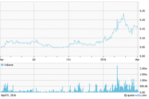
12 Month Stock Chart

exs chart

Explor Signs Memorandum of Understanding With First Nations

Posted by AGORACOM-JC at 10:42 AM on Wednesday, March 23rd, 2016

Exs_logo

  • Signed a Memorandum of Understanding (“MOU”) with the Matachewan First Nation of Matachewan, Ontario and the Mattagami First Nation of Gogama, Ontario (the “First Nations”), with respect to the Kidd Township Property
  • MOU will serve as a framework to govern the relationship between Explor and the First Nations in accordance with their intention of further building a relationship characterized by cooperation and mutual respect, in connection with the development of the Kidd Township Property

ROUYN-NORANDA, CANADA–(March 23, 2016) – Explor Resources Inc. (“Explor” or the “Corporation”) (TSX VENTURE:EXS)(OTCQX:EXSFF)(FRANKFURT:E1H1)(BERLIN:E1H1) is pleased to announce that it has signed a Memorandum of Understanding (“MOU”) with the Matachewan First Nation of Matachewan, Ontario and the Mattagami First Nation of Gogama, Ontario (the “First Nations”), with respect to the Kidd Township Property.

The MOU will serve as a framework to govern the relationship between Explor and the First Nations in accordance with their intention of further building a relationship characterized by cooperation and mutual respect, in connection with the development of the Kidd Township Property. This represents an important milestone in moving the project forward and we welcome our new partners.

The MOU sets out the areas in which Explor and the First Nations have agreed to work together notably on mutual key interests such as environmental protection, employment and business opportunities, education and training for the First Nations communities.

Chris Dupont, President and CEO of Explor Resources, stated that “Explor is committed to working in partnership with the First Nations in the development of the Kidd Township Property. Explor looks forward to building a strong relationship with the First Nations that will be beneficial to both parties.”

In order to instill a relationship with the First Nations, Explor will issue 500,000 common shares to both the Matachewan and the Mattagami First Nations. This issuance of equity enables the Matachewan and the Mattagami First Nations to become shareholders and participate in the success of Explor Resources as Explor moves the Kidd Township Project to the next phase in the development of the property. This issuance of shares is subject to the approval of the regulatory authorities.

The Kidd Township consists of 222 unpatented mining units and 5 patented claims located in the Kidd, Wark, Carnegie and Prosser Townships in the Timmins-Porcupine Mining Camp for a total 3,593 hectares. The property is contiguous and to the west, south, north and east of the Glencore Kidd Creek Mine. The property is located 20 kilometers north of the city of Timmins on Highway 655.

The most obvious topographical feature in the area is the Glencore Kidd Creek open pit mine, located in the central portion of Explor’s Kidd Township group of Properties. The Glencore Kidd Creek Mine has produced over 140,000,000 tons of copper/Zinc ore since it discovery in 1964. Explor believes in the cluster effect of base metal deposits and believes there are several other deposits located in the vicinity of the Glencore Kidd Creek mine.

Explor Resources Inc. is a publicly listed company trading on the TSX Venture (EXS), on the OTCQX (EXSFF) and on the Frankfurt and Berlin Stock Exchanges (E1H1).

This Press Release was prepared by Explor. Neither the TSX Venture Exchange nor its Regulation Services Provider (as that term is defined in the Policies of the TSX Venture Exchange) has reviewed or accepts responsibility for the adequacy or accuracy of this release.

About Explor Resources Inc.

Explor Resources Inc. is a Canadian-based natural resources company with mineral holdings in Ontario, Québec, Saskatchewan and New Brunswick. Explor is currently focused on exploration in the Abitibi Greenstone Belt. The belt is found in both provinces of Ontario and Québec with approximately 33% in Ontario and 67% in Québec. The Belt has produced in excess of 180,000,000 ounces of gold and 450,000,000 tonnes of cu-zn ore over the last 100 years. The Corporation was continued under the laws of Alberta in 1986 and has had its main office in Québec since 2006.

Explor Resources Flagship project is the Timmins Porcupine West (TPW) Project located in the Porcupine mining camp, in the Province of Ontario. Teck Resources Ltd. is currently conducting an exploration program as part of an earn-in on the TPW property. The TPW mineral resource (Press Release dated August 27, 2013) includes the following:

Open Pit Mineral Resources at a 0.30 g/t Au cut-off grade are as follows:
Indicated: 213,000 oz (4,283,000 tonnes at 1.55 g/t Au)
Inferred: 77,000 oz (1,140,000 tonnes at 2.09 g/t Au)
Underground Mineral Resources at a 1.70 g/t Au cut-off grade are as follows:
Indicated: 396,000 oz (4,420,000 tonnes at 2.79 g/t Au)
Inferred: 393,000 oz (5,185,000 tonnes at 2.36 g/t Au)

This document may contain forward-looking statements relating to Explor’s operations or to the environment in which it operates. Such statements are based on operations, estimates, forecasts and projections. They are not guarantees of future performance and involve risks and uncertainties that are difficult to predict and may be beyond Explor’s control. A number of important factors could cause actual outcomes and results to differ materially from those expressed in forward-looking statements, including those set forth in other public filling. In addition, such statements relate to the date on which they are made. Consequently, undue reliance should not be placed on such forward-looking statements. Explor disclaims any intention or obligation to update or revise any forward-looking statements, whether as a result of new information, future events or otherwise, save and except as may be required by applicable securities laws.

Explor Resources Inc.
Christian Dupont
President
819-797-6050
888-997-4630 or 819-797-4630
[email protected]
www.explorresources.com

Explor Announces Ogden Property Diamond Drilling Program

Posted by AGORACOM-JC at 4:19 PM on Tuesday, March 22nd, 2016

Exs_logo

  • Announced the commencement of a Diamond Drilling Program on the Ogden Gold Property
  • Consist of 8 mining claims (70 mineral claim units) covering 1,120 hectares situated in the Porcupine mining division, district of Cochrane, in the Ogden Township, Ontario
  • Claims are contiguous and to the east of the Timmins Porcupine West Property

ROUYN-NORANDA, QC–(March 22, 2016) – Explor Resources Inc. (“Explor” or “the Corporation”) (TSX VENTURE: EXS) (OTCQX: EXSFF) (FRANKFURT: E1H1) (BERLIN: E1H1) is pleased to announce the commencement of a Diamond Drilling Program on the Ogden Gold Property. The property is located 12 kilometers southwest of the city of Timmins, Ontario. The property consist of 8 mining claims (70 mineral claim units) covering 1,120 hectares situated in the Porcupine mining division, district of Cochrane, in the Ogden Township, Ontario. These claims are contiguous and to the east of the Timmins Porcupine West Property as shown on the attached map. Access to the property is via an all-weather road from Highway 101 to the west of the property.

The exploration program will consist of 3,000 meters of diamond drilling. This diamond drill program will concentrate on geophysical targets as identified by Explor’s recent ground geophysical survey and IP work conducted by Inmet and Knick Exploration. Analysis of existing geophysical data along with Explor’s recently completed work has revealed a major geological structure similar to the one located on Explor’s Timmins Porcupine West Gold Property. It would appear to be a continuation of the Bristol Porphyry on the other side of the Mattagami River fault. Previous reconnaissance exploration work by Inmet Mines defined several induced polarization anomalies (1997) and these are incorporated with recent I.P. survey data as the surveys were completed by the same service company and all original data has been acquired by Explor Resources.

The property has been previously explored by Hollinger Mines, Tex-Sol Exploration, Inmet Mining Corporation, Amax Mineral Exploration, Noranda Exploration and Knick Exploration. The majority of the holes drilled by previous operators were less than 100 meters in length. Historically on the Ogden Property, the only hole that hit significant mineralization was a diamond drill hole by Tex-Sol Exploration in 1965 which returned 6.0 g/t Au over 9.1 m at a shallow depth. On the TPW Gold Property significant mineralization was intersected below 300 meters of vertical depth requiring drill holes of 500 to 600 m in length.

The most significant deposits in Timmins are spatially associated with porphyry units that are in proximity to the Porcupine Destor Fault. The deposits appear to be also associated with splay faults that trend off and to the North of the Porcupine Destor fault inside an interpreted splay fault corridor.

The Ogden Property is contiguous on the east side of the Timmins Porcupine West Property. The Timmins Porcupine West Project has as a Target Model “The Hollinger-McIntyre-Coniaurum System.” The Hollinger-McIntyre-Coniaurum (HMC) System has produced a total of over 30 million oz of gold is spatially associated with the Pearl Lake Porphyry. The high-grade gold bearing quartz veins which hosted the bulk of the gold at the HMC occurred in the adjacent mafic volcanics, located outboard from the porphyry itself.

Chris Dupont P.Eng is the qualified person responsible for the information contained in this release.

Explor Resources Inc. is a publicly listed company trading on the TSX Venture (EXS), on the OTCQX (EXSFF) and on the Frankfurt and Berlin Stock Exchanges (E1H1).

This Press Release was prepared by Explor. Neither the TSX Venture Exchange nor its Regulation Services Provider (as that term is defined in the Policies of the TSX Venture Exchange) has reviewed or accepts responsibility for the adequacy or accuracy of this release.

About Explor Resources Inc.

Explor Resources Inc. is a Canadian-based natural resources company with mineral holdings in Ontario, Québec, Saskatchewan and New Brunswick. Explor is currently focused on exploration in the Abitibi Greenstone Belt. The belt is found in both provinces of Ontario and Québec with approximately 33% in Ontario and 67% in Québec. The Belt has produced in excess of 180,000,000 ounces of gold and 450,000,000 tonnes of cu-zn ore over the last 100 years. The Corporation was continued under the laws of Alberta in 1986 and has had its main office in Québec since 2006.

Explor Resources Flagship project is the Timmins Porcupine West (TPW) Project located in the Porcupine mining camp, in the Province of Ontario. Teck Resources Ltd. is currently conducting an exploration program as part of an earn-in on the TPW property. The TPW mineral resource (Press Release dated August 27, 2013) includes the following:

Open Pit Mineral Resources at a 0.30 g/t Au cut-off grade are as follows:

Indicated: 213,000 oz (4,283,000 tonnes at 1.55 g/t Au)
Inferred: 77,000 oz (1,140,000 tonnes at 2.09 g/t Au)

Underground Mineral Resources at a 1.70 g/t Au cut-off grade are as follows:

Indicated: 396,000 oz (4,420,000 tonnes at 2.79 g/t Au)
Inferred: 393,000 oz (5,185,000 tonnes at 2.36 g/t Au)

This document may contain forward-looking statements relating to Explor’s operations or to the environment in which it operates. Such statements are based on operations, estimates, forecasts and projections. They are not guarantees of future performance and involve risks and uncertainties that are difficult to predict and may be beyond Explor’s control. A number of important factors could cause actual outcomes and results to differ materially from those expressed in forward-looking statements, including those set forth in other public filling. In addition, such statements relate to the date on which they are made. Consequently, undue reliance should not be placed on such forward-looking statements. Explor disclaims any intention or obligation to update or revise any forward-looking statements, whether as a result of new information, future events or otherwise, save and except as may be required by applicable securities laws.

Image Available: http://www.marketwire.com/library/MwGo/2016/3/22/11G088665/Images/zz-68a5c2d7e88582b4afeeada2bec0cf63.jpg

For further information please contact:

Christian Dupont
President
Tel: 888-997-4630 or 819-797-4630
Fax: 819-797-6050
Website: www.explorresources.com
Email: [email protected]

INTERVIEW: Liberty Star Discusses Exploration Plan of Operation on Hay Mountain Project

Posted by AGORACOM-JC at 9:17 AM on Monday, March 21st, 2016

  • Arizona State Land Department (“ASLD”) has notified Liberty Star that the Company’s Exploration Plan of Operation (“EPO”) for the Hay Mountain Project is approved.
  • Approval of the EPO is for Mineral Exploration Permits (MEPs) held by Liberty Star in the Hay Mountain Project Are

Hub On AGORACOM / Corporate Profile / Watch Interview

Liberty Star’s Hay Mountain Project Plan of Operation Approved by Arizona State Land Department

Posted by AGORACOM-JC at 9:07 AM on Thursday, March 17th, 2016

Lsumlogo_with_slogan2_20130730

  • Announce that the Arizona State Land Department (“ASLD”) has notified Liberty Star that the Company’s Exploration Plan of Operation (“EPO”) for the Hay Mountain Project is approved
  • Approval of the EPO is for Mineral Exploration Permits (MEPs)

TUCSON, AZ–(March 17, 2016) – Liberty Star Uranium & Metals Corp. (“Liberty Star” or the “Company”) (OTCBB: LBSR) (OTC PINK: LBSR) is pleased to announce that the Arizona State Land Department (“ASLD”) has notified Liberty Star that the Company’s Exploration Plan of Operation (“EPO”) for the Hay Mountain Project is approved. The approval of the EPO is for Mineral Exploration Permits (MEPs) held by Liberty Star in the Hay Mountain Project Area (southeast of Tombstone) for the period January 26, 2016 to September 29, 2016.

The ASLD concluded a lengthy review of the Company’s EPO, which included submission of detailed transportation site access procedures, multiple cultural resources and vegetation surveys, drilling plans for multiple targets, and a project completion program. Additionally, Liberty Star was required to pay plant/vegetation restoration fees prior to ASLD approval.

James Briscoe, Liberty Star’s CEO/Chief Geologist, commented, “The approval of the Exploration Plan of Operation is an important early milestone in what we believe will be the development of another important porphyry copper and associated metals center in southeast Arizona. This ASLD action is the culmination of four years of hard work and scientific inquiry, which will lead to more of both in the coming months and years. While we continue to refine the sequence of drilling of the permitted drill holes, we are gratified knowing that we can proceed with actual drilling as soon as funds are raised. Additionally, we plan to permit drill holes on BLM (US Bureau of Land Management) administered land, which we believe to be a straight forward process, and positioning drill holes on Patented (Fee Simple) lands which are also part of the Hay Mountain target. On that front, we continue to work diligently to fund Phase 1 plans and lay the foundation for ongoing exploration and development work at the Hay Mountain Project.”

“James A. Briscoe” James A. Briscoe, Professional Geologist, AZ CA
CEO/Chief Geologist
Liberty Star Uranium & Metals Corp.

About Liberty Star

Liberty Star is an Arizona-based mineral exploration company engaged in the acquisition, exploration, and development of mineral properties in Arizona and the southwest USA. Currently, the Company controls properties which are located over what management considers some of North America’s richest mineralized regions for copper, gold, silver, molybdenum (moly), and uranium.

Forward Looking Statements

This press release may contain “forward-looking statements” within the meaning of Section 27A of the Securities Act of 1933, as amended, and Section 21E of the Securities Exchange Act of 1934. “Forward-looking statements” describe future expectations, plans, results, or strategies and are generally preceded by words such as “may,” “future,” “plan” or “planned,” “will” or “should,” “expected,” “anticipates,” “draft,” “eventually” or “projected.” You are cautioned that such statements are subject to a multitude of risks and uncertainties that could cause future circumstances, events, or results to differ materially from those projected in the forward-looking statements, including the risks that actual results may differ materially from those projected in the forward-looking statements as a result of various factors, and other risks identified in the Company’s Registration Statement on Form S-1 filed on February 24, 2016 and other filings made by the Company with the U.S. Securities and Exchange Commission.

Follow Liberty Star Uranium & Metals Corp. on Agoracom, Facebook , LinkedIn & Twitter@LibertyStarLBSR

View the Hay Mountain Phase 1 Presentation at LibertyStarUranium.com

Contact:
Agoracom Investor Relations
[email protected]
http://agoracom.com/ir/libertystar
or
Liberty Star Uranium & Metals Corp.
Tracy Myers
520-425-1433
Investor Relations
[email protected]

Durango Acquires Additional Ground South of Metanor Moroy

Posted by AGORACOM-JC at 9:13 AM on Monday, March 14th, 2016

Logo

  • Announces that it has acquired via GESTIM online staking additional ground south of Metanor Resources, TSX-MTO, Moroy discovery
  • Previously acquired ground adjacent to Metanor ground as announced on March 3rd, 2016 which encompasses the Bachelor Lake Mine and the Moroy discovery and the staking in this news releases is additional ground adjacent the previous ground

Vancouver, BC / March 14, 2016 – Durango Resources Inc. (the “Company” or “Durango”) announces that it has acquired via GESTIM online staking additional ground south of the Moroy discovery of Metanor Resources, TSX.V-MTO. On March 3rd, 2016, Durango announced that it had acquired ground adjacent to Metanor’s Bachelor Lake Mine and it’s Moroy discovery in Québec, and the staking in this news release is in addition to the previously announced ground.

About Durango
Durango is a natural resources company engaged in the acquisition and exploration of mineral properties. The Company has a 100% interest in the Mayner’s Fortune and Smith Island limestone properties in northwest British Columbia, the Decouverté gold property in the Abitibi Region of Quebec, and the NMX East lithium property near the Whabouchi mine in Québec, the Buckshot property near the Miller Mine in Québec, as well as three sets of claims in the Labrador nickel corridor.

For further information on Durango, please refer to its SEDAR profile at www.sedar.com.

Marcy Kiesman, Chief Executive Officer
Telephone: 604.428.2900 or 604.339.2243
Facsimile: 888.266.3983
Email: [email protected]
Website: www.durangoresourcesinc.com

Forward-Looking Statements

This document may contain or refer to forward-looking information based on current expectations, including, but not limited to timing of mineral resource estimates, future exploration or project development programs and the impact on the Company of these events. Forward-looking information is subject to significant risks and uncertainties, as actual results may differ materially from forecasted results. Forward-looking information is provided as of the date hereof and we assume no responsibility to update or revise them to reflect new events or circumstances. For a detailed list of risks and uncertainties relating to Durango, please refer to the Company’s prospectus filed on its SEDAR profile at www.sedar.com.
Neither TSX Venture Exchange nor its Regulation Services Provider (as that term is defined in the policies


Durango Releases New Information on its Whitney Northwest Project, Identifies Favourable Geology

Posted by AGORACOM-JC at 10:44 AM on Wednesday, March 9th, 2016

Logo

  • Announced further information on its 100% owned Whitney Northwest Gold Project located north of the Lake Shore Gold Corp (T-LSG) and Goldcorp Inc. (T-G) joint venture Whitney Project
  • In addition to its close proximity to the Whitney Project, on which Lake Shore Gold announced an expansion to its mineralized zone on February 4, 2016, Durango’s Whitney Northwest property is located directly adjacent to the north of the Bell Creek Mine Complex

Vancouver, BC / March 9, 2016 – Durango Resources Inc. (the “Company” or “Durango”) (V-DGO) (OTC-ATOXF) is pleased to announce further information on its 100% owned Whitney Northwest Gold Project located north of the Lake Shore Gold Corp (T-LSG) and Goldcorp Inc. (T-G) joint venture Whitney Project north of the city of Timmins, Ontario, and 9 kilometres ENE of the city of Timmins.

In addition to its close proximity to the Whitney Project, on which Lake Shore Gold announced an expansion to its mineralized zone on February 4, 2016, Durango’s Whitney Northwest property is located directly adjacent to the north of the Bell Creek Mine Complex, which includes the Bell Creek Mine and the Bell Creek Mill. The Whitney Northwest project is located approximately 4 kilometres west-northwest of the Bell Creek Mine resource.

Durango’s Whitney Northwest property covers the projected extensions of several north-south and east-west trending regionally mapped faults. The Porcupine area is well known for hosting mesothermal Archean shear-hosted gold deposits. Durango’s Whitney Northwest Gold Project lies between the gold-bearing Destor-Porcupine Fault to the south (>60 million oz of historic production to the end of 2006) and the gold-bearing regional Pipestone Fault to the north.

The most significant gold mineralization at the nearby Bell Creek Mine occurs in two lithostructural settings: a) near or along an ultramafic-to-mafic contact zones (the Bell Creek and West Zone), and b) within the mafic volcanics sequence (North Zones). (2) Initial work at Durango’s Whitney Northwest is planned to consist of detailed field mapping and attention will be given to identifying geological analogues to nearby deposits such as the Bell Creek Mine and the Lake Shore Gold Whitney Project.

The Bell Creek Mine is an underground mine located northeast of Timmins, Ontario, close to Goldcorp Inc.’s (“Goldcorp’s”) Hoyle Pond Mine. The mine is a former producer that was operated by a number of owners from 1987 to 1994, producing a total of 113,000 ounces of gold (576,000 tons at an average grade of 5.6 grams per tonne). Lake Shore Gold acquired the Bell Creek Mine, and the Bell Creek Mill, in December 2007 from the Porcupine Joint Venture, a joint venture between Goldcorp and Kinross Gold Corporation. (1)

The Bell Creek Mill receives ore from the Lake Shore Gold Bell Creek Mine and Timmins West Mine and currently achieves throughput levels of around 3,500 tonnes per day. During the first nine months of 2015, a total of 952,000 tonnes of ore was processed at Bell Creek Mill at an average grade of 4.6 gpt and an average recovery rate of 96.7%, resulting in 136,200 recovered ounces of production. (1)

The technical contents of this release were approved by Mr. Case Lewis, a vendor of the property and a Qualified Person as defined by National Instrument 43-101. The property has not been the subject of a National Instrument 43-101 report.

About the Whitney Northwest Project

Durango’s Whitney Northwest Gold Project is located within the western part of the Archean-aged Southern Abitibi Greenstone Belt, a supracrustal complex of moderately to highly deformed, usually greenschist facies, volcanic-dominated oceanic assemblages that are approximately 2.7 million years in age. Supracrustal rocks in the Timmins region are assigned as members of seven volcanic and two sedimentary assemblages within the Western Abitibi Subprovince of the Superior Province. Intrusions were emplaced during the Archean and Proterozoic eons.

The Whitney Northwest Gold Project lies between the gold-bearing Destor-Porcupine Fault to the south (>60 million ounces of historic production to the end of 2006) and the gold-bearing regional Pipestone Fault to the north. The property covers the interpreted extension of several north-south and east-west trending faults.

About Durango

Durango is a natural resources company engaged in the acquisition and exploration of mineral properties. The Company has a 100% interest in the Mayner’s Fortune and Smith Island limestone properties in northwest British Columbia, the Decouverte and Trove gold properties in the Abitibi Region of Quebec, and the NMX East lithium property near the Whabouchi mine in Quebec, the Buckshot Property near the Miller Mine in Quebec, as well as three sets of claims in the Labrador nickel corridor.

References

  1. (1)Lake Shore Gold Corp website, http://www.lsgold.com/, March 2016.
  2. (2)NI 43-101 Technical Report, Updated Mineral Reserve Estimate for Bell Creek Mine, Hoyle Township, Timmins, Ontario, Canada. Prepared for Lake Shore Gold Corp. Kallio, E. & Vaz N., March 27, 2015.

For further information on Durango, please refer to its SEDAR profile at www.sedar.com.

Marcy Kiesman, Chief Executive Officer

Telephone: 604.428.2900 or 604.339.2243

Facsimile: 888.266.3983

Email: [email protected]

Website: www.durangoresourcesinc.com

Forward-Looking Statements

This document may contain or refer to forward-looking information based on current expectations, including, but not limited to timing of mineral resource estimates, future exploration or project development programs and the impact on the Company of these events. Forward-looking information is subject to significant risks and uncertainties, as actual results may differ materially from forecasted results. Forward-looking information is provided as of the date hereof and we assume no responsibility to update or revise them to reflect new events or circumstances. For a detailed list of risks and uncertainties relating to Durango, please refer to the Company’s prospectus filed on its SEDAR profile at www.sedar.com.

Neither TSX Venture Exchange nor its Regulation Services Provider (as that term is defined in the policies of the TSX Venture Exchange) accepts responsibility for the adequacy or accuracy of this release.

CLIENT FEATURE: American Creek (AMK: TSX-V) – Recent samples average 27,092 gm/tonne silver and 248 gm/tonne gold

Posted by AGORACOM-JC at 2:56 PM on Tuesday, March 8th, 2016

AMK: TSX-V

RECENT HIGHLIGHTS

  • Specimens from the structure averages 27,092 gm/tonne silver and 248 gm/tonne gold
  • Results from outcrop specimens of high grade material collected on its Electrum property from the Shiny Cliff vein on the North Face Showing Read More

Exceptional Properties

Electrum Gold-Silver Property, British Columbia – 100% owned

The Electrum property has a rich history with some of the highest grade hand-mined ore mined in North America combined with excellent logistics. The property is located directly between two high-grad vein gold/silver mines; the past producing Silbak Premier mine and Pretiums high-grade Brucejack mine (production in 2017).All three lie within the Iskut mineral district (a particularly prolific part of the Canadian Cordillera) with numerous geological similarities between them.

The Electrum Property holds significant potential to attract mining companies when considering its high-grade nature combined with the exceptional logistics in place.

  • Located in the prolific Golden Triangle of northwestern British Columbia, an area encompassing mineral rich belts that host more than 43 past producing mines including Eskay Creek, Silbak Premier, Granduc and Big Missouri.It is a hotbed of activity with one new mine having come online in 2015 (Imperial Mines Red Chris) and another scheduled for 2017 (Pretium Brucejack) and at least three more world-class mining projects headed toward production.
  • Located in a particularly rich valley with 4 past producing commercial mines and a 5th in the adjacent valley.
  • Includes the historic East Gold Mine that had intermittent small-scale production of approximately 46 tonnes of ore with grades averaging 1,661 grams of gold per tonne and 2,596 grams of silver per tone (roughly 50oz gold with 75oz silver).
  • Mineralization is believed to be very similar to the silver-gold-base metal veins responsible for the precious metal mineralization found in the Silbak Premier Mine and the Big Missouri mines (located in same extended valley).
  • Pretiums Brucejack Summary Report (for exploration) compares itself geologically to the Silbak Premier mine as well.
  • Exceptional gold and silver assays including 440 g/t gold with 400 g/t silver over 0.52m, with numerous silver intervals of 583g/t, 501 g/t, 420 g/t, 384 g/t in core, and surface samples of 80.96 g/t gold with 80,818 g/t silver, 694 g/t gold with 550 g/t silver, 54.77 g/t gold with 14,903 g/t silver, 615 g/t gold with 616 g/t silver.
  • A very successful program was run in 2015 wherein:
    • A new approach focusing on high-grade was employed very successfully
    • A new zone of gold / silver mineralization was discovered
    • A better understanding of the property geology was obtained
    • Surface samples from the structure averages 27,092 gm/tonne silver and 248 gm/tonne gold


  • The program proved the Electrum Property has multiple high-grade gold-silver epithermal breccia vein systems and gave us a better understating of their sequencing.
  • Excellent logistics including road access, power located 2 km away and a bulk tonnage shipping port and supportive mining town located just40 km away in a mining friendly jurisdiction.

The high-grade ELECTRUM PROPERTY recently had a program run on it. CLICK HERE for the Electrum presentation and HERE for the 2015 drill program presentation. The highly mineralized gossans on the Electrum are shown in the image at the top of this page.

2015 Drill Program Presentation

Treaty Creek Gold-Copper Property, British Columbia – 51% Joint Venture

Treaty Creek Property


Treaty Creek is located in British Columbia’s prolific Golden Triangle; one of the richest areas of mineralization in the world with one new mine having come online in 2015 (Imperial Mines Red Chris) and another scheduled for 2017 (Pretium Brucejack) and at least three more world-class mining projects headed toward production.

Mineralization in the Treaty Creek claims area lies within the same broad hydrothermal system that generated the several deposits on the Seabridge Gold KSM and the Pretivm Brucejack properties that lie immediately southwest of the Treaty Creek claims. So far over 130 million ounces of gold, 800 million ounces of silver and 20 billion pounds of copper (all categories included), representing one of the greatest concentrations of metal value on the planet, have been delineated within the geological system shared by KSM, Brucejack, and Treaty Creek.

Seabridge Gold’s KSM is the world’s largest undeveloped gold/silver project by reserves while Pretium’s Brucejack is the highest grading undeveloped large-scale gold project in the world.KSM has just past the environmental and permitting stage while the Brucejack is in construction phase.
Treaty Creek is part of the same large hydrothermal system as it’s neighbours, hosts the same bedrock geology as its neighbours, the same magneto-telluric (MT) anomalies that proved to be large deposits on the neighbours claims, the same major fault system (Sulphurets) that is responsible for KSM’s deposits, and initial exploration and drilling show similar results to initial drilling on KSM.

The Treaty Creek property is in a strategic location as it’s included in Seabridge’s plan for the KSM to go into production. Seabridge has proposed twin tunnels that would take the KSM ore through American Creek’s Treaty Creek property to a processing plant and tailings pond.